|
search place name
|
||
Ułtowo (Poland)Ułtowo is a town in Poland. An overview map of the region around Ułtowo is displayed below.
regional and 3d topo map of Ułtowo, Poland ::

Ułtowo airports ::
The nearest airport is WAW - Warsaw Okecie, located 94.3 km south east of Ułtowo.
Other airports nearby include GDN - Gdansk Lecha Walesy (211.4 km north west), Nearby towns ::
Leszczyno Księże (1.9km south) //
Mokrz (2.2km north east) //
Giżyno (2.2km north west) //
Szewce (3.7km north) //
Zagróbka (2.9km south east) //
Łęg Kasztelanski (3.9km north) //
Leszczyno Szlacheckie (3.9km south) //
Dębsk (4.3km north west) //
Kuchary Jeżewo (4.3km south west) //
Siemienie (5.6km north) //
Bielsk (3.4km west) //
Jaroszewo Biskupie (3.8km south east) //
Józinek (5.7km south) //
Łęg Kościelny (6.0km north) //
Śniegocin (6.0km south) //
Ciołkówko (6.0km south) //
Łęg (6.0km north) //
Łęg-Probostwo (6.0km north) //
Tłubice (6.0km north) //
Aleksandrowo (5.0km south east) //
Zagroba Kościelna (5.0km south east) //
Drwały (5.0km south west) //
Gutowo Stardzyno (7.4km north) //
Chudzyno (4.5km east) //
Cekanowo (4.5km west) //
Mogielnica (7.5km north) //
Chudzynko (4.9km east) //
Psary (4.9km east) //
Jaczewo Jeziorne (4.9km west) //
[all distances 'as the bird flies' and approximate] 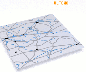
Disclaimer :: Information on this page comes without warranty of any kind |
||
|
Where is Ułtowo? Elevation and coordinates ::
Latitude (lat): 52°40'0"N Longitude (lon): 19°51'0"E
Elevation (approx.): 135m (map arrows pan, magnifying glasses zoom) |
||
|
Visiting Ułtowo? Hotel/Accommodation ::
Book a hotel in Ułtowo Travel Guide ::
Buy a travel guide for Poland rental cars ::
car rental offers GPS waypoint ::
download a GPX waypoint (PoI) of Ułtowo for your GPS receiver
|
||