|
search place name
|
||
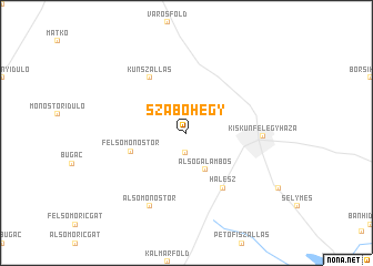
Szabóhegy (Bács-Kiskun, Hungary)Szabóhegy is a town in the Bács-Kiskun region of Hungary. An overview map of the region around Szabóhegy is displayed below.
regional and 3d topo map of Szabóhegy, Hungary ::
Szabóhegy airports ::
The nearest airport is BUD - Budapest Ferihegy, located 89.5 km north west of Szabóhegy.
Other airports nearby include ARW - Arad (128.5 km south east), TSR - Timisoara Traian Vuia (156.6 km south east), OSI - Osijek (158.4 km south west), DEB - Debrecen (163.4 km north east), Nearby towns ::
Felsõgalambos (2.0km south) //
Ringhegy (2.2km north west) //
Alsógalambos (3.9km south) //
Felsőmonostor (4.2km south west) //
Kunszállás (6.1km north west) //
Halesz (6.1km south east) //
Kiskunfélegyháza (5.3km east) //
Alsómonostor (7.8km south) //
[all distances 'as the bird flies' and approximate] 
Disclaimer :: Information on this page comes without warranty of any kind |
||
|
Where is Szabóhegy? Elevation and coordinates ::
Latitude (lat): 46°43'0"N Longitude (lon): 19°47'0"E
Elevation (approx.): 101m (map arrows pan, magnifying glasses zoom) |
||
|
Visiting Szabóhegy? Hotel/Accommodation ::
Book a hotel in Szabóhegy Travel Guide ::
Buy a travel guide for Hungary rental cars ::
car rental offers GPS waypoint ::
download a GPX waypoint (PoI) of Szabóhegy for your GPS receiver
|
||