|
search place name
|
||
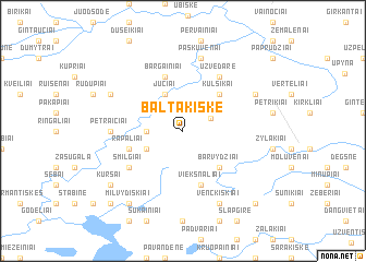
Baltakiškė (Lithuania)Baltakiškė is a town in Lithuania. An overview map of the region around Baltakiškė is displayed below.
regional and 3d topo map of Baltakiškė, Lithuania ::
Baltakiškė airports ::
The nearest airport is KGD - Kaliningrad Khrabrovo, located 163.8 km south west of Baltakiškė.
Nearby towns ::
Luokė (2.0km north east) //
Biržuvėnai (2.1km west) //
Paliepiai (2.8km south west) //
Juciai (3.8km north) //
Barvydžiai (4.3km south east) //
Kulšikai (4.2km north east) //
Rapaliai (3.6km south west) //
Viekšnaliai (5.7km south) //
Bargainiai (5.7km north) //
Smilgiai (4.8km south west) //
Užvėdarė (5.9km north) //
Petraičiai (4.2km west) //
Paškuvėnai (7.5km north) //
Venckiškiai (7.7km south) //
Jonaičiai (5.6km north east) //
Mediškiai (5.6km north west) //
Milvydiškiai (8.0km south west) //
Kuršai (6.9km south west) //
Kalniškiai Naujasis (8.5km south west) //
Leinartiškė (8.5km south east) //
[all distances 'as the bird flies' and approximate] 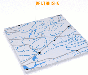 Places with similar names to Baltakiškė, Lithuania :: Disclaimer :: Information on this page comes without warranty of any kind |
||
|
Where is Baltakiškė? Elevation and coordinates ::
Latitude (lat): 55°53'0"N Longitude (lon): 22°30'0"E
Elevation (approx.): 153m (map arrows pan, magnifying glasses zoom) |
||
|
Visiting Baltakiškė? Hotel/Accommodation ::
Book a hotel in Baltakiškė Travel Guide ::
Buy a travel guide for Lithuania rental cars ::
car rental offers GPS waypoint ::
download a GPX waypoint (PoI) of Baltakiškė for your GPS receiver
|
||