|
search place name
|
||
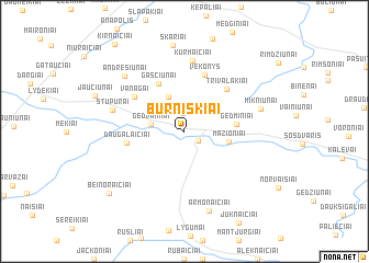
Burniškiai (Lithuania)Burniškiai is a town in Lithuania. An overview map of the region around Burniškiai is displayed below.
regional and 3d topo map of Burniškiai, Lithuania ::
Nearby towns ::
Pamūšis (1.2km south east) //
Jonaičiai (1.9km north) //
Gedvainiai (2.0km west) //
Cigoniškiai (3.7km north) //
Mažioniai (2.7km south east) //
Gedminiai (3.0km east) //
Gasčiūnai (5.1km north) //
Daugalaičiai (3.5km west) //
Trivalakiai (4.9km north east) //
Vėkonys (5.9km north) //
Vanagai (4.5km north west) //
Kurmaičiai (7.2km north) //
Stupurai (4.6km north west) //
Mikniūnai (4.9km north east) //
Andrešiūnai (6.6km north west) //
Armonaičiai (8.2km south) //
Skariai (8.8km north) //
Beinoraičiai (7.6km south west) //
[all distances 'as the bird flies' and approximate]  Places with similar names to Burniškiai, Lithuania ::
// Berensch (DE)
// Brańsk (PL)
// Brońsko (PL)
// Bryńsk (PL)
// Baroniškiai (LT)
// Baroniškiai (LT)
// Burniškė (LT)
// Burniškiai (LT)
// Branošica (BA)
// Brănişca (RO)
Disclaimer :: Information on this page comes without warranty of any kind |
||
|
Where is Burniškiai? Elevation and coordinates ::
Latitude (lat): 56°6'1"N Longitude (lon): 23°39'0"E
Elevation (approx.): 75m (map arrows pan, magnifying glasses zoom) |
||
|
Visiting Burniškiai? Hotel/Accommodation ::
Book a hotel in Burniškiai Travel Guide ::
Buy a travel guide for Lithuania rental cars ::
car rental offers GPS waypoint ::
download a GPX waypoint (PoI) of Burniškiai for your GPS receiver
|
||