|
search place name
|
||
Naciūnai (Lithuania)Naciūnai is a town in Lithuania. An overview map of the region around Naciūnai is displayed below.
regional and 3d topo map of Naciūnai, Lithuania ::
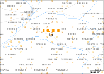
Nearby towns ::
Šilainėliai (1.9km north) //
Pėdžiai (1.9km south) //
Slikiai (1.1km east) //
Nociūnai (1.1km west) //
Šilainiai (2.8km north east) //
Kudžionys (2.8km north west) //
Zutkiai (3.9km north) //
Kuigaliai (4.3km south east) //
Saviečiai (4.3km south west) //
Žiogaičiai (4.3km south west) //
Pabarupys (5.6km north) //
Medekšiai (3.7km north west) //
Činkiai (3.7km north west) //
Voveriškiai (5.7km south) //
Bubliai (5.7km north) //
Gentrinai (4.9km north west) //
Bubleliai (5.9km north) //
Taučiūnai (7.4km north) //
Akmeniai (4.2km east) //
Nortautai (4.6km south east) //
Puzaičiai (4.6km south west) //
Barsukinė (7.5km south) //
Pabarupis (6.4km south east) //
Liogailiškiai (5.3km north west) //
Baldinkiai (5.6km north east) //
Pociūnai-Pamėklės (5.6km south west) //
Eiguliai (8.1km north west) //
Kėdainiai (9.3km north west) //
[all distances 'as the bird flies' and approximate] 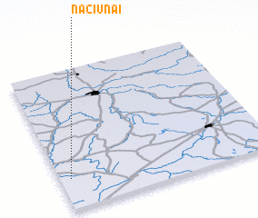 Places with similar names to Naciūnai, Lithuania ::
Disclaimer :: Information on this page comes without warranty of any kind |
||
|
Where is Naciūnai? Elevation and coordinates ::
Latitude (lat): 55°13'0"N Longitude (lon): 24°3'0"E
Elevation (approx.): 57m (map arrows pan, magnifying glasses zoom) |
||
|
Visiting Naciūnai? Hotel/Accommodation ::
Book a hotel in Naciūnai Travel Guide ::
Buy a travel guide for Lithuania rental cars ::
car rental offers GPS waypoint ::
download a GPX waypoint (PoI) of Naciūnai for your GPS receiver
|
||