|
search place name
|
||
Petraičiai (Lithuania)Petraičiai is a town in Lithuania. An overview map of the region around Petraičiai is displayed below.
regional and 3d topo map of Petraičiai, Lithuania ::

Nearby towns ::
Rukuižiai (1.3km north west) //
Ramoškiai (2.5km south east) //
Bandoriai (2.3km north east) //
Daukšiai (3.1km north west) //
Skaistgirys (4.1km south) //
Žučiai (3.3km north east) //
Kemsiai (4.6km south) //
Reibiniai (6.1km south) //
Pabaliai (4.3km north west) //
Gražaičiai (4.9km south west) //
Stungiai (4.0km west) //
Augstkalne (7.1km north) //
Domeikiai (6.7km south west) //
Klinti (8.3km north) //
Lankaičiai (6.8km south east) //
Maželiai (7.6km south west) //
Dzeguzēni (8.3km north) //
Normančiai (8.7km south) //
Šluostikiai (9.0km south east) //
[all distances 'as the bird flies' and approximate] 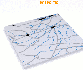 Places with similar names to Petraičiai, Lithuania ::
// Pittrich (DE)
// Padrečiai (LT)
// Pėteraičiai (LT)
// Petraičiai (LT)
// Petraičiai (LT)
// Petraičiai (LT)
// Petraičiai (LT)
// Petraičiai (LT)
// Petraičiai (LT)
// Putrišiai (LT)
Disclaimer :: Information on this page comes without warranty of any kind |
||
|
Where is Petraičiai? Elevation and coordinates ::
Latitude (lat): 56°20'35"N Longitude (lon): 23°22'4"E
Elevation (approx.): 56m (map arrows pan, magnifying glasses zoom) |
||
|
Visiting Petraičiai? Hotel/Accommodation ::
Book a hotel in Petraičiai Travel Guide ::
Buy a travel guide for Lithuania rental cars ::
car rental offers GPS waypoint ::
download a GPX waypoint (PoI) of Petraičiai for your GPS receiver
|
||