|
search place name
|
||
Tärivere (Ida-Virumaa, Estonia)Tärivere is a town in the Ida-Virumaa region of Estonia. An overview map of the region around Tärivere is displayed below.
regional and 3d topo map of Tärivere, Estonia ::

Tärivere airports ::
The nearest airport is QVY - Utti, located 198.7 km north of Tärivere.
Other airports nearby include LPP - Lappeenranta (219.0 km north), Nearby towns ::
Lipniku (1.4km south east) //
Iisaku (2.4km south) //
Tammetaguse (1.9km north east) //
Lõpe (1.4km south west) //
Koldamäe (2.4km north east) //
Kasevälja (5.5km south) //
Jõuga (3.6km north east) //
Sõrumäe (5.3km north east) //
Sälliku (7.3km south) //
Vaikla (6.1km south east) //
Porskovo (6.9km south east) //
Varesmetsa (4.6km east) //
Väike-Pungerja (7.4km north) //
Pootsiku (8.4km south east) //
[all distances 'as the bird flies' and approximate] 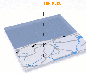 Places with similar names to Tärivere, Estonia ::
Disclaimer :: Information on this page comes without warranty of any kind |
||
|
Where is Tärivere? Elevation and coordinates ::
Latitude (lat): 59°7'22"N Longitude (lon): 27°18'48"E
Elevation (approx.): 49m (map arrows pan, magnifying glasses zoom) |
||
|
Visiting Tärivere? Hotel/Accommodation ::
Book a hotel in Tärivere Travel Guide ::
Buy a travel guide for Estonia rental cars ::
car rental offers GPS waypoint ::
download a GPX waypoint (PoI) of Tärivere for your GPS receiver
|
||