|
search place name
|
||
Espolón (Pinar del Río, Cuba)Espolón is a town in the Pinar del Río region of Cuba. An overview map of the region around Espolón is displayed below.
regional and 3d topo map of Espolón, Cuba ::

Espolón airports ::
The nearest airport is LCL - La Coloma, located 18.9 km south west of Espolón.
Other airports nearby include GER - Nueva Gerona Rafael Cabrera (106.8 km south east), HAV - Havana Jose Marti Intl (129.9 km north east), Nearby towns ::
Mojica (0.0km north) //
Lázaro (0.0km north) //
El Cafetal (1.9km south) //
Mezano (1.9km south) //
Marabú (1.9km north) //
Mamey Chico (1.7km west) //
Siete Palmas (1.7km east) //
Arroyo Mamacos (1.7km east) //
Santa Elena (1.7km east) //
La Esperanza (2.5km south west) //
La Granada (2.5km south west) //
La Central (2.5km north west) //
Becerra Rodríguez (2.5km north west) //
Punta Gorda (2.5km north west) //
María (2.5km north west) //
Manresa (2.5km north east) //
Santa Rosa (2.5km north west) //
Isleña (2.5km north west) //
Manguito (2.5km north east) //
La Esperanza (2.5km north east) //
La Jagua (2.5km north west) //
Paraíso (2.5km north east) //
La Julia (2.6km north east) //
Cayo Cristóbal (2.7km north west) //
Puerta de Golpe (3.4km south) //
Mayólica (3.7km south) //
La Jagua (3.4km west) //
La Metuca (3.4km west) //
Arroyo Grande (3.4km west) //
[all distances 'as the bird flies' and approximate] 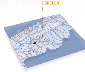
Disclaimer :: Information on this page comes without warranty of any kind |
||
|
Where is Espolón? Elevation and coordinates ::
Latitude (lat): 22°29'0"N Longitude (lon): 83°33'0"W
Elevation (approx.): 38m (map arrows pan, magnifying glasses zoom) |
||
|
Visiting Espolón? Hotel/Accommodation ::
Book a hotel in Espolón Travel Guide ::
Buy a travel guide for Cuba rental cars ::
car rental offers GPS waypoint ::
download a GPX waypoint (PoI) of Espolón for your GPS receiver
|
||