|
search place name
|
||
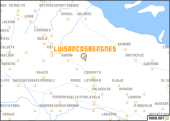
Luis Arcos Bergnes (Villa Clara, Cuba)Luis Arcos Bergnes is a town in the Villa Clara region of Cuba. An overview map of the region around Luis Arcos Bergnes is displayed below.
regional and 3d topo map of Luis Arcos Bergnes, Cuba ::
Luis Arcos Bergnes airports ::
The nearest airport is SNU - Santa Clara Abel Santamaria, located 56.5 km west of Luis Arcos Bergnes.
Other airports nearby include AVI - Ciego De Avila Maximo Gomez (73.9 km south east), CFG - Cienfuegos Jaime Gonzalez (105.2 km west), CMW - Camaguey Ignacio Agramonte Intl (192.1 km south east), Nearby towns ::
Antonio Blanco (0.0km north) //
La Lima (0.0km north) //
Aguada de Carillo (2.5km south west) //
Gueibá (3.4km west) //
Convento (4.1km south east) //
Pando (5.8km south) //
La Trampa (5.8km south) //
Ricardo Mojica (5.5km west) //
Buena Vista (6.8km west) //
La Caridad (7.1km west) //
Quintana (7.8km north west) //
Valdesuso (8.2km south east) //
Seibabo (8.6km east) //
La Lima (8.8km north west) //
El Bijo (8.8km south east) //
Remates de Ariosa (9.9km south west) //
[all distances 'as the bird flies' and approximate] 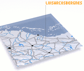 Places with similar names to Luis Arcos Bergnes, Cuba ::
// Luis Arcos Bergnes (CU)
// Luis Arcos Bergnes (CU)
Disclaimer :: Information on this page comes without warranty of any kind |
||
|
Where is Luis Arcos Bergnes? Elevation and coordinates ::
Latitude (lat): 22°21'0"N Longitude (lon): 79°25'0"W
Elevation (approx.): 125m (map arrows pan, magnifying glasses zoom) |
||
|
Visiting Luis Arcos Bergnes? Hotel/Accommodation ::
Book a hotel in Luis Arcos Bergnes Travel Guide ::
Buy a travel guide for Cuba rental cars ::
car rental offers GPS waypoint ::
download a GPX waypoint (PoI) of Luis Arcos Bergnes for your GPS receiver
|
||