|
search place name
|
||
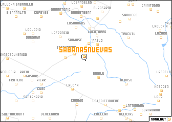
Sabanas Nuevas (Ciego de Ávila, Cuba)Sabanas Nuevas is a town in the Ciego de Ávila region of Cuba. An overview map of the region around Sabanas Nuevas is displayed below.
regional and 3d topo map of Sabanas Nuevas, Cuba ::
Sabanas Nuevas airports ::
The nearest airport is AVI - Ciego De Avila Maximo Gomez, located 44.9 km north west of Sabanas Nuevas.
Other airports nearby include CMW - Camaguey Ignacio Agramonte Intl (73.6 km south east), SNU - Santa Clara Abel Santamaria (173.5 km north west), VTU - Las Tunas Hermanos Ameijeiras (179.4 km south east), CFG - Cienfuegos Jaime Gonzalez (207.4 km west), Nearby towns ::
Carmen (2.8km north west) //
Solapa (3.0km north) //
La Pastora (3.9km north) //
Pablo (4.3km north east) //
San José (4.4km north west) //
San Isidro (4.2km west) //
Ensilú (4.4km south east) //
Tres Marías (4.5km north west) //
La Cotorra (5.9km north) //
La Loma (6.8km south west) //
El Canario (7.2km north) //
Los Mangos (7.7km north) //
La Francia (7.5km north west) //
Alonso (9.6km south east) //
Corea (11.1km north east) //
[all distances 'as the bird flies' and approximate] 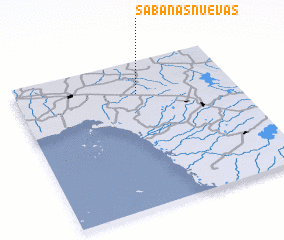 Places with similar names to Sabanas Nuevas, Cuba ::
// Sabanas Nuevas (CU)
Disclaimer :: Information on this page comes without warranty of any kind |
||
|
Where is Sabanas Nuevas? Elevation and coordinates ::
Latitude (lat): 21°46'45"N Longitude (lon): 78°26'45"W
Elevation (approx.): 43m (map arrows pan, magnifying glasses zoom) |
||
|
Visiting Sabanas Nuevas? Hotel/Accommodation ::
Book a hotel in Sabanas Nuevas Travel Guide ::
Buy a travel guide for Cuba rental cars ::
car rental offers GPS waypoint ::
download a GPX waypoint (PoI) of Sabanas Nuevas for your GPS receiver
|
||