|
search place name
|
||
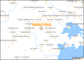
San Antonio (Holguín, Cuba)San Antonio is a town in the Holguín region of Cuba. An overview map of the region around San Antonio is displayed below.
regional and 3d topo map of San Antonio, Cuba ::
San Antonio airports ::
The nearest airport is HOG - Holguin Frank Pais Intl, located 51.7 km west of San Antonio.
Other airports nearby include MOA - Moa Orestes Acosta (98.7 km east), BYM - Bayamo Carlos Manuel De Cespedes (99.3 km south west), SCU - Santiago De Cuba Antonio Maceo Intl (103.0 km south), GAO - Guantanamo Mariana Grajales (114.4 km south east), Nearby towns ::
Cortaderas (1.9km north) //
El Cacao (2.5km north east) //
Arroyón de Flores (3.7km north) //
Loma de Pilón (3.5km east) //
Georgina (4.1km north east) //
El Tejar (4.1km north west) //
Los Negritos (3.9km south east) //
Cuatrocientas Rosas (3.9km north east) //
Italiana (5.1km north east) //
Loma Alta (5.1km north west) //
El Cerro (5.1km north west) //
Nuevo Mundo (5.2km west) //
El Sitio (5.6km north) //
Caridad (5.6km north) //
Pilón (5.8km south) //
Los Berros (5.8km north) //
Carrera Palmas (5.8km north) //
La Vega (5.5km west) //
Santa Ana (5.5km west) //
La Diputada (5.5km west) //
Hojas Anchas (6.4km south west) //
La Julia (6.4km north west) //
Fusil (6.5km north east) //
Las Antillitas (6.4km south east) //
Los Pilones (6.4km south east) //
Bijarú (6.9km west) //
El Cerrote (6.9km west) //
Batey (7.4km south) //
Zaldívar (7.4km north) //
[all distances 'as the bird flies' and approximate]  Places with similar names to San Antonio, Cuba ::
// San Antônio (BR)
// San Antonio (BZ)
// San Antonio (BZ)
// San Antonio (BZ)
// San Antonio (BZ)
// San Antonio (US)
// San Antonio (US)
// San Antonio (US)
// San Antonio (PA)
// San Antonio (PA)
Disclaimer :: Information on this page comes without warranty of any kind |
||
|
Where is San Antonio? Elevation and coordinates ::
Latitude (lat): 20°54'0"N Longitude (lon): 75°50'0"W
Elevation (approx.): 38m (map arrows pan, magnifying glasses zoom) |
||
|
Visiting San Antonio? Hotel/Accommodation ::
Book a hotel in San Antonio Travel Guide ::
Buy a travel guide for Cuba rental cars ::
car rental offers GPS waypoint ::
download a GPX waypoint (PoI) of San Antonio for your GPS receiver
|
||