|
search place name
|
||
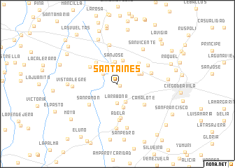
Santa Inés (Ciego de Ávila, Cuba)Santa Inés is a town in the Ciego de Ávila region of Cuba. An overview map of the region around Santa Inés is displayed below.
regional and 3d topo map of Santa Inés, Cuba ::
Santa Inés airports ::
The nearest airport is AVI - Ciego De Avila Maximo Gomez, located 20.4 km north of Santa Inés.
Other airports nearby include CMW - Camaguey Ignacio Agramonte Intl (114.6 km south east), SNU - Santa Clara Abel Santamaria (132.9 km north west), CFG - Cienfuegos Jaime Gonzalez (164.5 km west), VTU - Las Tunas Hermanos Ameijeiras (220.6 km south east), Nearby towns ::
Quemado Nuevo (0.4km south east) //
Caguazal (0.9km north) //
Tablones (2.7km north west) //
La Rabona (3.1km south) //
La Mariana (3.1km south) //
Jicotea (3.3km north) //
San José (3.5km north) //
Zaragoza (3.6km north east) //
El Maniadero (3.8km north) //
Pitajones (3.9km south) //
Antonio Telles (4.0km north east) //
Santa Margarita (4.5km north east) //
Las Coloradas (4.6km north west) //
El Dátil (4.9km north west) //
Camalote (5.2km south east) //
Dificultad (5.5km south) //
San Ramón (5.3km south west) //
El Anoncillo (5.3km east) //
Adela (5.7km south) //
La Margarita (5.4km north east) //
San Francisco (6.3km north) //
San Vicente (6.7km north east) //
Raúl Martínez (7.1km south) //
Albertina (7.1km south) //
Vista Alegre (6.7km west) //
Santa Petronila (7.6km north) //
La Onelia (7.4km west) //
Las Palmas (7.5km east) //
El Mamey (8.8km north) //
[all distances 'as the bird flies' and approximate]  Places with similar names to Santa Inés, Cuba ::
// Santa Inês (BR)
// Santa Inês (BR)
// Santa Inês (BR)
// Santo Inácio (BR)
// Santo Inácio (BR)
// Santo Inácio (BR)
// Santo Inácio (BR)
// Santo Inácio (BR)
// Santo Inácio (BR)
// Santa Ynez (US)
Disclaimer :: Information on this page comes without warranty of any kind |
||
|
Where is Santa Inés? Elevation and coordinates ::
Latitude (lat): 21°51'8"N Longitude (lon): 78°51'11"W
Elevation (approx.): 59m (map arrows pan, magnifying glasses zoom) |
||
|
Visiting Santa Inés? Hotel/Accommodation ::
Book a hotel in Santa Inés Travel Guide ::
Buy a travel guide for Cuba rental cars ::
car rental offers GPS waypoint ::
download a GPX waypoint (PoI) of Santa Inés for your GPS receiver
|
||