|
search place name
|
||
Vegas del Río (Sancti Spíritus, Cuba)Vegas del Río is a town in the Sancti Spíritus region of Cuba. An overview map of the region around Vegas del Río is displayed below.
regional and 3d topo map of Vegas del Río, Cuba ::

Vegas del Río airports ::
The nearest airport is AVI - Ciego De Avila Maximo Gomez, located 69.6 km north east of Vegas del Río.
Other airports nearby include SNU - Santa Clara Abel Santamaria (102.2 km north west), CFG - Cienfuegos Jaime Gonzalez (116.2 km north west), CMW - Camaguey Ignacio Agramonte Intl (162.7 km east), Nearby towns ::
San Carlos (2.1km north) //
El Rubio (2.7km north west) //
El Níspero (3.5km west) //
San Andrés (4.0km north) //
Heriberto Orellanes (3.8km south west) //
Las Guásimas (4.1km south west) //
El Mamey (4.0km north west) //
Buena Vista (4.3km north east) //
Corralillo (5.2km north east) //
Los Tamarindos (5.4km east) //
Caimiabo (6.9km east) //
Ciego de Guacará (7.1km west) //
Mapos (7.2km east) //
Peralejo (7.4km south east) //
Las Juntas de Vendavales (7.9km north) //
Sabanas de Caimiabo (7.7km south east) //
Mapos (7.9km south west) //
San Fernando (10.3km south west) //
Caimiabo Arriba (10.3km north east) //
[all distances 'as the bird flies' and approximate] 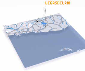 Places with similar names to Vegas del Río, Cuba :: Disclaimer :: Information on this page comes without warranty of any kind |
||
|
Where is Vegas del Río? Elevation and coordinates ::
Latitude (lat): 21°43'52"N Longitude (lon): 79°23'0"W
Elevation (approx.): 44m (map arrows pan, magnifying glasses zoom) |
||
|
Visiting Vegas del Río? Hotel/Accommodation ::
Book a hotel in Vegas del Río Travel Guide ::
Buy a travel guide for Cuba rental cars ::
car rental offers GPS waypoint ::
download a GPX waypoint (PoI) of Vegas del Río for your GPS receiver
|
||