|
search place name
|
||
Gjirokastër (Gjirokastër, Albania)Gjirokastër is a town in the Gjirokastër region of Albania. An overview map of the region around Gjirokastër is displayed below.
regional and 3d topo map of Gjirokastër, Albania ::

Gjirokastër airports ::
The nearest airport is CFU - Kerkyra/corfu Ioannis Kapodistrias Intl, located 56.1 km south of Gjirokastër.
Other airports nearby include IOA - Ioannina (72.1 km south east), KSO - Kastoria Aristotelis (105.6 km north east), OHD - Ohrid (132.8 km north), PVK - Preveza Aktio (138.6 km south east), Nearby towns ::
Gerhot (1.7km north west) //
Arshi-Lëngo (2.3km north east) //
Lazarat (3.3km south) //
Kordhocë (3.1km south east) //
Valare (5.5km north) //
Derviçian (5.6km south east) //
Asim Zeneli (4.9km east) //
Dhoksat (6.3km north east) //
Mashkullorë (6.4km north west) //
Krinë (5.9km north east) //
Këllëz (7.0km north east) //
Qestorat (6.9km north east) //
Mingul (7.8km north) //
Nokovë (8.1km north) //
Tranoshishtë (6.9km north east) //
Goranxi (7.8km south east) //
Vanistër (8.5km south east) //
Çepunë (8.6km north west) //
Bulo (8.0km south east) //
Haskovë (9.2km south east) //
Kodër (9.7km north west) //
Dhuvjan (10.1km south east) //
[all distances 'as the bird flies' and approximate] 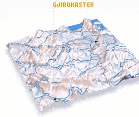 Places with similar names to Gjirokastër, Albania :: Disclaimer :: Information on this page comes without warranty of any kind |
||
|
Where is Gjirokastër? Elevation and coordinates ::
Latitude (lat): 40°4'33"N Longitude (lon): 20°8'20"E
Elevation (approx.): 286m (map arrows pan, magnifying glasses zoom) |
||
|
Visiting Gjirokastër? Hotel/Accommodation ::
Book a hotel in Gjirokastër Travel Guide ::
Buy a travel guide for Albania rental cars ::
car rental offers GPS waypoint ::
download a GPX waypoint (PoI) of Gjirokastër for your GPS receiver
|
||