|
search place name
|
||
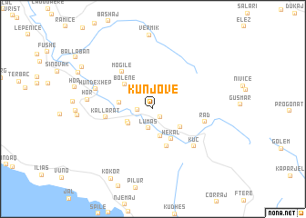
Kunjovë (Vlorë, Albania)Kunjovë is a town in the Vlorë region of Albania. An overview map of the region around Kunjovë is displayed below.
regional and 3d topo map of Kunjovë, Albania ::
Kunjovë airports ::
The nearest airport is CFU - Kerkyra/corfu Ioannis Kapodistrias Intl, located 68.9 km south of Kunjovë.
Other airports nearby include IOA - Ioannina (105.1 km south east), KSO - Kastoria Aristotelis (129.1 km east), TIA - Tirana Rinas (133.3 km north), OHD - Ohrid (133.8 km north east), Nearby towns ::
Zelishtë (1.2km south east) //
Pajame (1.4km west) //
Lumas (2.4km south) //
Bletëz (2.8km south west) //
(( Martokë )) (2.9km south west) //
Grabovë (3.5km south) //
Rrëza-Borshe (3.4km south east) //
Fusha e Gjormit (3.2km west) //
Hekal (4.1km south east) //
Bolenë (4.0km north west) //
Fushë Brrati (4.8km south) //
Mogilë (5.4km north west) //
Kallarat (4.6km west) //
Rad (5.1km east) //
Kuç (6.0km south east) //
Hundëxhep (5.9km north west) //
Hor (6.3km west) //
Kokor (9.4km south west) //
Shalës (8.4km north west) //
[all distances 'as the bird flies' and approximate]  Places with similar names to Kunjovë, Albania ::
// Gongeva (PT)
// Čanjeva (BA)
// Kanjevi (BA)
// Canjiva (MZ)
// Kiên Giáp Ha (VN)
// Kunějov (CZ)
// Qanjowgheh (AF)
// Čanjevo (HR)
// Konjuva (CS)
// Canjufa (GW)
Disclaimer :: Information on this page comes without warranty of any kind |
||
|
Where is Kunjovë? Elevation and coordinates ::
Latitude (lat): 40°12'57"N Longitude (lon): 19°47'37"E
Elevation (approx.): 499m (map arrows pan, magnifying glasses zoom) |
||
|
Visiting Kunjovë? Hotel/Accommodation ::
Book a hotel in Kunjovë Travel Guide ::
Buy a travel guide for Albania rental cars ::
car rental offers GPS waypoint ::
download a GPX waypoint (PoI) of Kunjovë for your GPS receiver
|
||