|
search place name
|
||
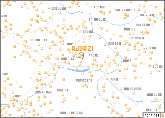
Ajvazi (Federacija Bosne i Hercegovine, Bosnia and Herzegovina)Ajvazi is a town in the Federacija Bosne i Hercegovine region of Bosnia and Herzegovina. An overview map of the region around Ajvazi is displayed below.
regional and 3d topo map of Ajvazi, Bosnia and Herzegovina ::
Ajvazi airports ::
The nearest airport is SJJ - Sarajevo, located 107.5 km south east of Ajvazi.
Other airports nearby include SPU - Split (117.9 km south west), OMO - Mostar (130.5 km south east), ZAD - Zadar (152.3 km west), OSI - Osijek (175.1 km north east), Nearby towns ::
Gornje Mile (0.4km north west) //
Mile (0.7km south west) //
Medarevići (1.0km north west) //
Rašlići (1.0km north west) //
Štrkalji (1.3km south) //
Donje Mile (1.9km south east) //
Brtani (1.8km north west) //
Matekale (1.7km north west) //
Ćosići (1.9km south east) //
Savičići (2.4km south west) //
Radići (1.9km east) //
Dodići (2.2km east) //
Zaskopolje (2.8km south east) //
Čusine (3.1km south) //
Gavrići (2.5km west) //
Vrbica (2.6km south east) //
Brišići (3.4km south) //
Božići (2.7km north west) //
Borci (3.0km north west) //
Travari (3.3km north west) //
Perkovići (3.9km north) //
Gojevići (3.2km north west) //
Zaovine (3.6km south west) //
Vinogradi (3.9km south) //
Prisoje (3.0km west) //
Jovići (4.2km north) //
Volijak (3.5km south east) //
Lehovci (3.4km south east) //
Šebezi (4.6km north) //
[all distances 'as the bird flies' and approximate]  Places with similar names to Ajvazi, Bosnia and Herzegovina ::
// Ajvazi (CS)
Disclaimer :: Information on this page comes without warranty of any kind |
||
|
Where is Ajvazi? Elevation and coordinates ::
Latitude (lat): 44°21'57"N Longitude (lon): 17°13'8"E
Elevation (approx.): 648m (map arrows pan, magnifying glasses zoom) |
||
|
Visiting Ajvazi? Hotel/Accommodation ::
Book a hotel in Ajvazi Travel Guide ::
rental cars ::
car rental offers GPS waypoint ::
download a GPX waypoint (PoI) of Ajvazi for your GPS receiver
|
||