|
search place name
|
||
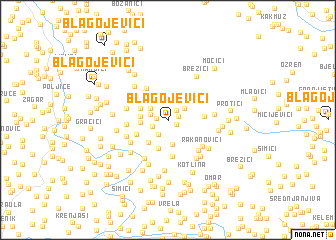
Blagojevići (Federacija Bosne i Hercegovine, Bosnia and Herzegovina)Blagojevići is a town in the Federacija Bosne i Hercegovine region of Bosnia and Herzegovina. An overview map of the region around Blagojevići is displayed below.
regional and 3d topo map of Blagojevići, Bosnia and Herzegovina ::
Blagojevići airports ::
The nearest airport is SJJ - Sarajevo, located 81.1 km south of Blagojevići.
Other airports nearby include OSI - Osijek (112.1 km north east), OMO - Mostar (143.7 km south), SPU - Split (189.8 km south west), DBV - Dubrovnik (220.9 km south), Nearby towns ::
Sjenokos (0.9km south east) //
Panići (0.9km east) //
Gornji Rakovac (0.9km west) //
Ilići (1.3km north east) //
Zavitalje (1.4km south west) //
Selišta (1.8km south) //
Jasik (1.6km north west) //
Kuselj (1.9km north east) //
Kneževići (1.9km north west) //
Bočinja Gornja (2.8km south) //
Lekići (2.1km west) //
Tornjak (2.2km west) //
Kereši (2.9km south west) //
Rudine (3.3km south) //
Palučak (2.6km north west) //
Vis (3.0km south west) //
Pilipovo (3.1km north west) //
Gajići (3.6km north west) //
Gojkovići (4.1km south) //
Gornja Bukovica (3.0km east) //
Ostojići (4.0km north west) //
Selište (3.8km north west) //
Babići (3.4km west) //
Simići (3.5km west) //
Rakanovići (4.1km south east) //
Pejići (3.9km south west) //
Bakotić (3.7km south west) //
Karačići (4.2km south east) //
Bočinja Donja (4.7km south west) //
[all distances 'as the bird flies' and approximate] 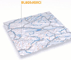 Places with similar names to Blagojevići, Bosnia and Herzegovina ::
// Blagojevići (BA)
// Blagojevići (BA)
// Blagojevići (BA)
// Blagojevići (BA)
// Blagojevići (BA)
// Blagojevići (BA)
// Blagojevići (BA)
// Blagojevići (BA)
// Blagojevići (BA)
// Blagojevići (BA)
Disclaimer :: Information on this page comes without warranty of any kind |
||
|
Where is Blagojevići? Elevation and coordinates ::
Latitude (lat): 44°32'57"N Longitude (lon): 18°12'25"E
Elevation (approx.): 396m (map arrows pan, magnifying glasses zoom) |
||
|
Visiting Blagojevići? Hotel/Accommodation ::
Book a hotel in Blagojevići Travel Guide ::
rental cars ::
car rental offers GPS waypoint ::
download a GPX waypoint (PoI) of Blagojevići for your GPS receiver
|
||