|
search place name
|
||
Gornja Mahala (Federacija Bosne i Hercegovine, Bosnia and Herzegovina)Gornja Mahala is a town in the Federacija Bosne i Hercegovine region of Bosnia and Herzegovina. An overview map of the region around Gornja Mahala is displayed below.
regional and 3d topo map of Gornja Mahala, Bosnia and Herzegovina ::

Gornja Mahala airports ::
The nearest airport is OSI - Osijek, located 87.2 km north east of Gornja Mahala.
Other airports nearby include SJJ - Sarajevo (103.9 km south), BEG - Beograd (157.6 km east), OMO - Mostar (168.4 km south), Nearby towns ::
Četovilja (1.0km north) //
Oštrikovac (0.9km south east) //
Ahmedagići (1.3km south west) //
Husanovići (1.8km south) //
Bušište (1.7km south east) //
Ilidža (2.0km south east) //
Avdići (2.2km south west) //
Guvna (2.1km south east) //
Škahovica (2.6km south) //
Strasevići (2.6km north) //
Kaltaruša (2.7km south) //
Karići (2.3km south west) //
Okići (2.5km north east) //
Todorovići (3.0km north) //
Soko (2.6km south east) //
Huskići (2.5km east) //
Jahijići (3.1km north east) //
Serhatlije (2.6km east) //
Čozalovo Brdo (3.6km south) //
Kahvedžije (3.6km south west) //
Omerbašići (3.0km south west) //
Rosići (3.7km north) //
Mustafići (3.3km south west) //
Babići (3.2km south west) //
Piskavica (3.7km south east) //
Čalići (2.9km west) //
Topalovići (3.3km north west) //
Pašalići (4.1km south) //
Delića Brdo (3.5km south east) //
[all distances 'as the bird flies' and approximate] 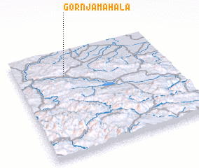 Places with similar names to Gornja Mahala, Bosnia and Herzegovina ::
// Gornja Mahala (BA)
// Gornja Mahala (BA)
// Gornja Mahala (BA)
// Gornja Mahala (BA)
// Gornja Mahala (BA)
// Gornja Mahala (BA)
// Gornja Mahala (BA)
// Gornja Mahala (BA)
// Gornja Mahala (BA)
// Gornja Mahala (BA)
Disclaimer :: Information on this page comes without warranty of any kind |
||
|
Where is Gornja Mahala? Elevation and coordinates ::
Latitude (lat): 44°45'35"N Longitude (lon): 18°19'9"E
Elevation (approx.): 603m (map arrows pan, magnifying glasses zoom) |
||
|
Visiting Gornja Mahala? Hotel/Accommodation ::
Book a hotel in Gornja Mahala Travel Guide ::
rental cars ::
car rental offers GPS waypoint ::
download a GPX waypoint (PoI) of Gornja Mahala for your GPS receiver
|
||