|
search place name
|
||
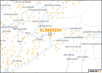
Al ‘Abbāsah (Ash Sharqīyah, Egypt)Al ‘Abbāsah is a town in the Ash Sharqīyah region of Egypt. An overview map of the region around Al ‘Abbāsah is displayed below.
regional and 3d topo map of Al ‘Abbāsah, Egypt ::
Al ‘Abbāsah airports ::
The nearest airport is CAI - Cairo Intl, located 54.7 km south west of Al ‘Abbāsah.
Other airports nearby include PSD - Port Said (96.4 km north east), ALY - Alexandria Intl (183.1 km north west), Nearby towns ::
Al ‘Abbāsah ash Sharqīyah (0.0km north) //
Al ‘Abbāsah ash Sharqīyah (0.0km north) //
Kafr al Bāţil (0.0km south east) //
Minshāt al ‘Abbāsah (0.8km south west) //
Kafr Abū Najm (1.2km north east) //
‘Izbat Tall ar Rakham (1.7km south east) //
Jazīrat al ‘Irāqī (2.7km south west) //
‘Izbat aţ Ţawāḩīn (3.1km south east) //
‘Izbat al ‘Amāyrah (3.3km south) //
Kafr al Faddān (3.0km west) //
Kafr al ‘Azzāzī (3.4km north west) //
Kafr ash Shaykh ‘Aţīyah (3.5km north east) //
Al Gharābiwah (3.5km north east) //
Al Gharābiwah (3.5km north east) //
‘Izbat Ḩusayn Abū ‘Ammār (4.2km south) //
Ashtīlah (4.4km south) //
Kafr Mushrif (4.4km south east) //
Al Masīd (4.4km south west) //
Tall Abū Ḩāmid (4.3km east) //
Abū Ḩammād al Maḩaţţah (4.3km west) //
Kafr Abū an Nūr (4.9km south) //
Abū Ḩammād (4.3km west) //
Abū Ḩammād al Maḩaţţah (4.3km west) //
Kafr Abū ad Duqūn (4.4km west) //
‘Izbat ath Thamānīn (5.2km south east) //
‘Izbat Falţas Jirjis (5.2km south west) //
Az̧ Z̧āhirīyah (5.0km north east) //
‘Izbat Mirshāq (5.6km south) //
An Nazlah (5.1km north west) //
[all distances 'as the bird flies' and approximate] 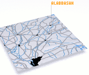 Places with similar names to Al ‘Abbāsah, Egypt ::
Disclaimer :: Information on this page comes without warranty of any kind |
||
|
Where is Al ‘Abbāsah? Elevation and coordinates ::
Latitude (lat): 30°32'19"N Longitude (lon): 31°42'40"E
Elevation (approx.): 10m (map arrows pan, magnifying glasses zoom) |
||
|
Visiting Al ‘Abbāsah? Hotel/Accommodation ::
Book a hotel in Al ‘Abbāsah Travel Guide ::
Buy a travel guide for Egypt rental cars ::
car rental offers GPS waypoint ::
download a GPX waypoint (PoI) of Al ‘Abbāsah for your GPS receiver
|
||