|
search place name
|
||
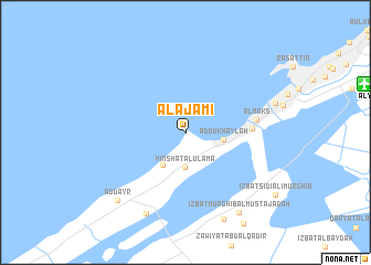
Al ‘Ajamī (Al Iskandarīyah, Egypt)Al ‘Ajamī is a town in the Al Iskandarīyah region of Egypt. An overview map of the region around Al ‘Ajamī is displayed below.
regional and 3d topo map of Al ‘Ajamī, Egypt ::
Al ‘Ajamī airports ::
The nearest airport is ALY - Alexandria Intl, located 16.3 km east of Al ‘Ajamī.
Other airports nearby include CAI - Cairo Intl (192.0 km south east), Nearby towns ::
Minshāt al ‘Ulamā (3.6km south) //
Al Hānūvīl (3.8km south west) //
Ad Dukhaylah (3.4km east) //
‘Izbat Wādī al Qamar (5.7km east) //
Al Maks (6.3km east) //
‘Izbat ‘Umar Abū Ḩafīz̧ah (8.9km south) //
‘Izbat al Musta‘marah (9.3km south) //
‘Izbat Murghib al Mustajadah (9.3km south east) //
Ad Dayr (9.1km south west) //
[all distances 'as the bird flies' and approximate]  Places with similar names to Al ‘Ajamī, Egypt ::
// Al Jamah (TN)
// Al Awjām (SA)
// Al Jimah (SA)
// Al Jūmā (SY)
// Aligêma (MZ)
// Al Jum‘ah (LY)
// Al Jāmi‘ah (IQ)
// Al Jum‘ah (IQ)
// Al Jāmi‘ah (SA)
// Al Jum‘ah (SA)
Disclaimer :: Information on this page comes without warranty of any kind |
||
|
Where is Al ‘Ajamī? Elevation and coordinates ::
Latitude (lat): 31°8'26"N Longitude (lon): 29°47'7"E
Elevation (approx.): 5m (map arrows pan, magnifying glasses zoom) |
||
|
Visiting Al ‘Ajamī? Hotel/Accommodation ::
Book a hotel in Al ‘Ajamī Travel Guide ::
Buy a travel guide for Egypt rental cars ::
car rental offers GPS waypoint ::
download a GPX waypoint (PoI) of Al ‘Ajamī for your GPS receiver
|
||