|
search place name
|
||
‘Izbat Amīn al Bahiyy (Al Buḩayrah, Egypt)‘Izbat Amīn al Bahiyy is a town in the Al Buḩayrah region of Egypt. An overview map of the region around ‘Izbat Amīn al Bahiyy is displayed below.
regional and 3d topo map of ‘Izbat Amīn al Bahiyy, Egypt ::

‘Izbat Amīn al Bahiyy airports ::
The nearest airport is ALY - Alexandria Intl, located 66.2 km west of ‘Izbat Amīn al Bahiyy.
Other airports nearby include CAI - Cairo Intl (121.9 km south east), PSD - Port Said (160.5 km east), Nearby towns ::
‘Izbat Yūsuf al ‘Askarī (1.1km east) //
‘Izbat Şināwī ash Sharqīyah (1.3km south west) //
‘Izbat ‘Alī Ḩāfiz̧ (1.9km north) //
Al Ibrāhīmīyah (1.9km south west) //
‘Izbat Muḩammad ar Rūmī (1.9km east) //
‘Izbat Aḩmad Ghazāl (2.2km north west) //
‘Izbat Aḩmad Luţfī (2.4km north east) //
‘Izbat Abū ‘Alī (2.6km south east) //
‘Izbat ‘Ashrah (2.5km south east) //
Kafr as Sābī (2.9km north) //
‘Izbat al Wābūr (3.0km west) //
‘Izbat Sayf ad Dīn al Baḩarīyah (3.5km north west) //
‘Izbat ‘Umrān (3.8km south east) //
Ad Daramallīyah (3.5km south west) //
Kafr al Ḩājjah (3.7km south east) //
Kafr al Ḩājah (3.7km south east) //
Imrī (3.8km north east) //
Şafţ al Mulūk (3.9km south west) //
Minshāt Ruzzāfah (3.7km east) //
Maḩallat Naşr (4.3km north) //
‘Izbat Silīm Bāshā (4.4km north) //
‘Izbat Aḩmad Farghalī (4.5km south) //
‘Izbat ad Daramallī (4.7km north) //
‘Izbat Al ‘Azīzī (4.2km north east) //
Jinbāwāy (4.4km south west) //
Abū Durrah (4.7km north east) //
‘Izbat Abū Zurayq (4.5km south west) //
‘Izbat aş Şabāḩāt (4.5km north west) //
‘Izbat al ‘Arqūb ash Sharqīyah (4.4km east) //
[all distances 'as the bird flies' and approximate] 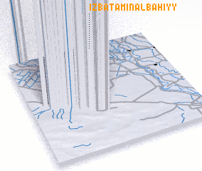 Places with similar names to ‘Izbat Amīn al Bahiyy, Egypt :: Disclaimer :: Information on this page comes without warranty of any kind |
||
|
Where is ‘Izbat Amīn al Bahiyy? Elevation and coordinates ::
Latitude (lat): 30°58'10"N Longitude (lon): 30°35'45"E
Elevation (approx.): 4m (map arrows pan, magnifying glasses zoom) |
||
|
Visiting ‘Izbat Amīn al Bahiyy? Hotel/Accommodation ::
Book a hotel in ‘Izbat Amīn al Bahiyy Travel Guide ::
Buy a travel guide for Egypt rental cars ::
car rental offers GPS waypoint ::
download a GPX waypoint (PoI) of ‘Izbat Amīn al Bahiyy for your GPS receiver
|
||