|
search place name
|
||
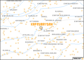
Kafr ‘Ubaydah (Ad Daqahlīyah, Egypt)Kafr ‘Ubaydah is a town in the Ad Daqahlīyah region of Egypt. An overview map of the region around Kafr ‘Ubaydah is displayed below.
regional and 3d topo map of Kafr ‘Ubaydah, Egypt ::
Kafr ‘Ubaydah airports ::
The nearest airport is PSD - Port Said, located 57.9 km east of Kafr ‘Ubaydah.
Other airports nearby include CAI - Cairo Intl (113.2 km south), ALY - Alexandria Intl (163.5 km west), Nearby towns ::
‘Izbat Shuhdī (0.5km west) //
‘Izbat ‘Alī Basyūnī (1.2km north west) //
Mīt al Khawlī al Muʼmin (1.2km west) //
Mît Tâhir (1.8km north west) //
Mît Ḥadîd (1.7km east) //
Ad Darākisah (2.2km west) //
Al Junaynah (3.1km south east) //
Minshât `Âṣim (3.1km east) //
Minyat an Naşr (3.2km north west) //
Mīt an Naşārá (3.2km north west) //
‘Izbat Mīt Ţarīf (3.7km south) //
Mît `Âṣim (3.6km east) //
Mīt Timāmah (4.0km north west) //
Ashmūn ar Rummān (4.1km south west) //
Kafr Abū Dhikrī (4.0km north east) //
Mīt as Sūdān (4.8km south west) //
Mīt Sa‘dān (4.8km south west) //
An Nazl (5.0km north) //
‘Izbat al Mizānīyah (4.6km east) //
‘Izbat ‘Abd al ‘Āl Ibrāhīm (5.0km south east) //
Mît Migâhid (5.2km south west) //
‘Izbat al Ḩinnāwī (5.8km south) //
Mît Sharaf (5.5km south west) //
Mît Ṭarîf (6.0km south) //
‘Izbat ash Sharikah (5.9km south west) //
Birimbāl al Jadīdah (5.5km north east) //
Birimbâl (5.5km north east) //
‘Izbat ash Shaykh Muḩammad (6.2km south east) //
‘Izbat at Tall (6.3km south east) //
[all distances 'as the bird flies' and approximate]  Places with similar names to Kafr ‘Ubaydah, Egypt ::
// Kafr Baţā (EG)
// Kavīrābād (IR)
// Kavīrābād (IR)
// Kīfārābād (IR)
// Kafr ‘Abdah (SY)
// Kafr ‘Abīd (SY)
// Kafr ‘Abbūd (EG)
// Kafr ‘Abduh (EG)
// Kafr ‘Ābid (EG)
// Kafr Abū ‘Ayyād (EG)
Disclaimer :: Information on this page comes without warranty of any kind |
||
|
Where is Kafr ‘Ubaydah? Elevation and coordinates ::
Latitude (lat): 31°7'6"N Longitude (lon): 31°39'44"E
Elevation (approx.): 6m (map arrows pan, magnifying glasses zoom) |
||
|
Visiting Kafr ‘Ubaydah? Hotel/Accommodation ::
Book a hotel in Kafr ‘Ubaydah Travel Guide ::
Buy a travel guide for Egypt rental cars ::
car rental offers GPS waypoint ::
download a GPX waypoint (PoI) of Kafr ‘Ubaydah for your GPS receiver
|
||