|
search place name
|
||
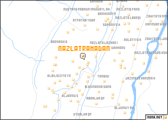
Nazlat Ramaḑān (Al Minyā, Egypt)Nazlat Ramaḑān is a town in the Al Minyā region of Egypt. An overview map of the region around Nazlat Ramaḑān is displayed below.
regional and 3d topo map of Nazlat Ramaḑān, Egypt ::
Nazlat Ramaḑān airports ::
The nearest airport is CAI - Cairo Intl, located 172.7 km north of Nazlat Ramaḑān.
Nearby towns ::
Al Bājhūr (1.0km south east) //
Banī Khālid al Baḩrīyah (1.2km south east) //
Banī Khālid (2.0km south) //
Banī ‘Āmir (1.9km south west) //
Kafr ‘Abd al Khāliq (2.2km west) //
Al ‘Idwah (2.7km north) //
Kafr Mahdī (2.4km east) //
Al Basqalūn (3.1km north) //
Al ‘Aqlīyah (3.3km south west) //
Nazlat Banī Khilf (3.8km south) //
Banī Khilf (3.8km south east) //
Nuqţat Muqaydim al Faʼr (4.8km south) //
Abū Bisht (4.8km south west) //
Nazlat al Azharī (4.8km north east) //
Shimm al Başal al Baḩrīyah (5.4km south) //
Minshāt Ḩalfah (5.4km north west) //
Barmashā (5.6km north west) //
Kafr al Maghrabī (5.6km west) //
Kafr al Maghribī (5.6km west) //
Al Qāyāt (5.6km west) //
Ţanbidī (6.1km south east) //
Nazlat Shīḩah (6.5km south) //
Nazlat Mūsá (5.9km west) //
Bilhāsah (6.0km east) //
Shimm al Başal al Qiblīyah (6.8km south) //
Minshāt Niyāzī (6.6km south west) //
Al Bilā‘izitayn (6.7km south west) //
Zāwiyat Barmashā (7.0km north west) //
Qaşr Lamlūm (7.2km north) //
[all distances 'as the bird flies' and approximate] 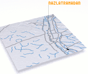 Places with similar names to Nazlat Ramaḑān, Egypt :: Disclaimer :: Information on this page comes without warranty of any kind |
||
|
Where is Nazlat Ramaḑān? Elevation and coordinates ::
Latitude (lat): 28°40'33"N Longitude (lon): 30°44'35"E
Elevation (approx.): 33m (map arrows pan, magnifying glasses zoom) |
||
|
Visiting Nazlat Ramaḑān? Hotel/Accommodation ::
Book a hotel in Nazlat Ramaḑān Travel Guide ::
Buy a travel guide for Egypt rental cars ::
car rental offers GPS waypoint ::
download a GPX waypoint (PoI) of Nazlat Ramaḑān for your GPS receiver
|
||