|
search place name
|
||
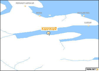
Kúvíkur (Strandasýsla, Iceland)Kúvíkur is a town in the Strandasýsla region of Iceland. An overview map of the region around Kúvíkur is displayed below.
regional and 3d topo map of Kúvíkur, Iceland ::
Kúvíkur airports ::
The nearest airport is IFJ - Isafjordur, located 76.0 km west of Kúvíkur.
Other airports nearby include RKV - Reykjavik (204.1 km south), KEF - Keflavik Nas (225.4 km south), Nearby towns ::
Árnes (7.6km north) //
[all distances 'as the bird flies' and approximate]  Places with similar names to Kúvíkur, Iceland ::
// Kuivakaare (EE)
// Kavgara (BA)
// Kavgora (RU)
// Kiavikere (CD)
// Kafkūr (IR)
// Gavagora (PG)
// Koivukari (FI)
// Koufí Kará (GR)
// Koffikro (CI)
// Kofi Akouri (CI)
Disclaimer :: Information on this page comes without warranty of any kind |
||
|
Where is Kúvíkur? Elevation and coordinates ::
Latitude (lat): 65°57'0"N Longitude (lon): 21°29'0"W
(map arrows pan, magnifying glasses zoom) |
||
|
Visiting Kúvíkur? Hotel/Accommodation ::
Book a hotel in Kúvíkur Travel Guide ::
Buy a travel guide for Iceland rental cars ::
car rental offers GPS waypoint ::
download a GPX waypoint (PoI) of Kúvíkur for your GPS receiver
|
||