|
search place name
|
||
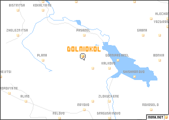
Dolni Okol (Bulgaria)Dolni Okol is a town in Bulgaria. An overview map of the region around Dolni Okol is displayed below.
regional and 3d topo map of Dolni Okol, Bulgaria ::
Dolni Okol airports ::
The nearest airport is SOF - Sofia, located 24.8 km north of Dolni Okol.
Other airports nearby include PDV - Plovdiv (120.6 km east), INI - Nis (164.5 km north west), SKP - Skopje (165.6 km west), KVA - Kavala Megas Alexandros Intl (197.7 km south east), Nearby towns ::
Gorni Okol (2.3km south east) //
Pasarel (5.6km north) //
Kalkovo (4.5km south east) //
Gorni Pasarel (5.5km east) //
[all distances 'as the bird flies' and approximate] 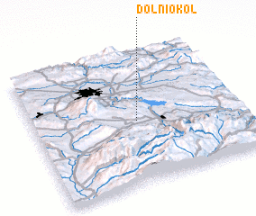 Places with similar names to Dolni Okol, Bulgaria ::
// Ta-longlao (MM)
// Dolna Kula (BG)
// Dealu Nucului (RO)
// Delingala (TD)
// Délingala (TD)
// Tolengole (CD)
// Talangalla (LK)
// Tillangala (LK)
// Dioulangueul (SN)
// Talinkoulou (SN)
Disclaimer :: Information on this page comes without warranty of any kind |
||
|
Where is Dolni Okol? Elevation and coordinates ::
Latitude (lat): 42°29'0"N Longitude (lon): 23°30'0"E
Elevation (approx.): 972m (map arrows pan, magnifying glasses zoom) |
||
|
Visiting Dolni Okol? Hotel/Accommodation ::
Book a hotel in Dolni Okol Travel Guide ::
Buy a travel guide for Bulgaria rental cars ::
car rental offers GPS waypoint ::
download a GPX waypoint (PoI) of Dolni Okol for your GPS receiver
|
||