|
search place name
|
||
Gola Glava (Bulgaria)Gola Glava is a town in Bulgaria. An overview map of the region around Gola Glava is displayed below.
regional and 3d topo map of Gola Glava, Bulgaria ::

Gola Glava airports ::
The nearest airport is SOF - Sofia, located 19.1 km south of Gola Glava.
Other airports nearby include INI - Nis (136.3 km north west), PDV - Plovdiv (148.7 km south east), CRA - Craiova (166.0 km north), SKP - Skopje (177.6 km south west), Nearby towns ::
Lukovo (0.0km north) //
Lazar (0.0km north) //
Ornicheto (0.0km north) //
Ostriyat Kamŭk (0.0km north) //
Sŭrtse (0.0km north) //
Turska Mogila (0.0km north) //
Zhelezopŭtna Spirka Lukovo (0.0km north) //
Rebrovo (2.3km north west) //
Vlado Trichkov (2.7km west) //
Batuliya (3.3km north east) //
Bakʼovo (5.4km east) //
Podgumer (7.4km south) //
Tompsŭn (7.5km north) //
Gnilyane (7.5km south) //
Kurilo (6.9km south west) //
Voynegovtsi (7.9km south) //
Novi Iskŭr (8.5km south west) //
Aleksandŭr Voykov (9.2km south west) //
[all distances 'as the bird flies' and approximate] 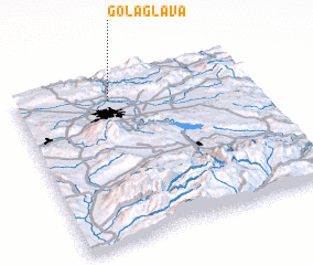 Places with similar names to Gola Glava, Bulgaria ::
// Qılqlov (AZ)
// Colle Calvo (IT)
// Gologlovo (BA)
// Glagolevo (RU)
// Kelkolovo (RU)
// Klukolovo (RU)
// Kolokolovo (RU)
// Kalokolevu (FJ)
// Kal Qaliifo (SO)
// Kolokolovo (RU)
Disclaimer :: Information on this page comes without warranty of any kind |
||
|
Where is Gola Glava? Elevation and coordinates ::
Latitude (lat): 42°52'0"N Longitude (lon): 23°24'0"E
Elevation (approx.): 845m (map arrows pan, magnifying glasses zoom) |
||
|
Visiting Gola Glava? Hotel/Accommodation ::
Book a hotel in Gola Glava Travel Guide ::
Buy a travel guide for Bulgaria rental cars ::
car rental offers GPS waypoint ::
download a GPX waypoint (PoI) of Gola Glava for your GPS receiver
|
||