|
search place name
|
||
Dauguļi (Krāslavas Rajons, Latvia)Dauguļi is a town in the Krāslavas Rajons region of Latvia. An overview map of the region around Dauguļi is displayed below.
regional and 3d topo map of Dauguļi, Latvia ::

Dauguļi airports ::
The nearest airport is MSQ - Minsk 2, located 224.8 km south of Dauguļi.
Nearby towns ::
Stalti (0.0km north) //
Spaļvi (1.0km east) //
Lukstani (1.9km south) //
Jalovecka (2.1km north west) //
Evarti (3.7km north) //
Pazauki (2.8km north west) //
Čaupi (3.8km north) //
Juchniški (3.1km east) //
Šakiņi (5.7km north) //
Kurpiņiki (5.7km north) //
Indrica (3.6km south west) //
Sloboda (3.6km south west) //
Krivoseļci (5.9km south) //
Adgoniški (5.9km north) //
Lielindrica (4.2km west) //
Shafranovo (7.5km south) //
Andžāni (6.4km north west) //
Varnaviči (5.6km south west) //
Balyuye (7.7km south) //
Berezki (6.9km south east) //
Paulinava (8.5km north east) //
Piedruja (8.5km south east) //
[all distances 'as the bird flies' and approximate] 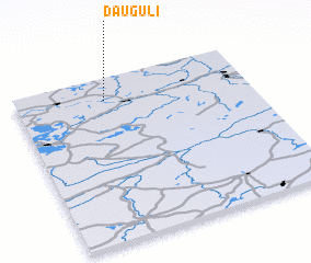 Places with similar names to Dauguļi, Latvia ::
Disclaimer :: Information on this page comes without warranty of any kind |
||
|
Where is Dauguļi? Elevation and coordinates ::
Latitude (lat): 55°52'0"N Longitude (lon): 27°23'0"E
Elevation (approx.): 129m (map arrows pan, magnifying glasses zoom) |
||
|
Visiting Dauguļi? Hotel/Accommodation ::
Book a hotel in Dauguļi Travel Guide ::
Buy a travel guide for Latvia rental cars ::
car rental offers GPS waypoint ::
download a GPX waypoint (PoI) of Dauguļi for your GPS receiver
|
||