|
search place name
|
||
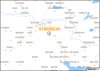
Staroščiki (Rēzeknes Rajons, Latvia)Staroščiki is a town in the Rēzeknes Rajons region of Latvia. An overview map of the region around Staroščiki is displayed below.
regional and 3d topo map of Staroščiki, Latvia ::
Nearby towns ::
Janopole (1.0km east) //
Čači (3.7km north) //
Reiki (4.2km south east) //
Plekšņi (3.6km north west) //
Rēzekne (4.8km north west) //
Michalava (4.8km north east) //
Bratova (7.4km south) //
Kivki (4.1km west) //
Spruževa (4.5km north east) //
Tēveņi (4.5km north west) //
Knutova (6.4km south east) //
Treuhi (6.4km south east) //
Gaiduļi (5.5km south west) //
Griškāni (6.9km north east) //
Šņitņiki (8.0km south east) //
Taudejāņi (8.5km north east) //
[all distances 'as the bird flies' and approximate]  Places with similar names to Staroščiki, Latvia ::
// Staroseyka (RU)
// Staryy Sig (RU)
// Storozhka (RU)
// Storozhka (RU)
// Strassegg (AT)
// Sætersaga (NO)
// Stróżewka (PL)
// Stróżówka (PL)
// Strużki (PL)
// Strzegów (PL)
Disclaimer :: Information on this page comes without warranty of any kind |
||
|
Where is Staroščiki? Elevation and coordinates ::
Latitude (lat): 56°28'0"N Longitude (lon): 27°22'0"E
Elevation (approx.): 170m (map arrows pan, magnifying glasses zoom) |
||
|
Visiting Staroščiki? Hotel/Accommodation ::
Book a hotel in Staroščiki Travel Guide ::
Buy a travel guide for Latvia rental cars ::
car rental offers GPS waypoint ::
download a GPX waypoint (PoI) of Staroščiki for your GPS receiver
|
||