|
search place name
|
||
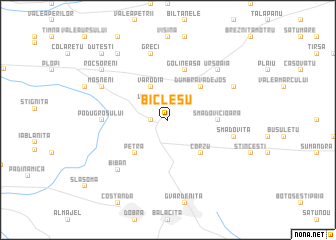
Bîcleşu (Covurlui, Romania)Bîcleşu is a town in the Covurlui region of Romania. An overview map of the region around Bîcleşu is displayed below.
regional and 3d topo map of Bîcleşu, Romania ::
Bîcleşu airports ::
The nearest airport is CRA - Craiova, located 62.9 km east of Bîcleşu.
Other airports nearby include CSB - Caransebes (125.1 km north west), SBZ - Sibiu (163.2 km north east), INI - Nis (163.6 km south west), SOF - Sofia (199.9 km south), Nearby towns ::
Selestiuţa (1.3km west) //
Giura (2.3km north west) //
Vlădica (2.3km north west) //
Dumbrava de Mijloc (2.3km north east) //
Dumbrava de Sus (3.9km north) //
Varodia (3.9km north) //
Petra (4.6km south west) //
Corzu (4.6km south east) //
Dumbrava de Jos (4.6km north east) //
Smadovicioara (4.0km east) //
Golineasa (5.7km north) //
Podu Grosului (5.3km west) //
Greci (7.5km north) //
Smadoviţa (5.6km east) //
Biban (6.8km south west) //
Ursoaia (6.8km north east) //
Higiu (6.8km north east) //
Brîgleasa (6.5km north west) //
Moşneni (6.5km north west) //
Albuleşti (6.5km north east) //
Rocşoreni (7.7km north west) //
Cătăneşti (8.4km north west) //
Blidaru (8.4km north west) //
Duţeşti (9.1km north west) //
[all distances 'as the bird flies' and approximate]  Places with similar names to Bîcleşu, Romania ::
// Boguiles (MA)
// Baclas (PH)
// Baglos (PH)
// Bagulaizo (PH)
// Bogueloosa (US)
// Boquillas (US)
// Böckelse (DE)
// Boquillas (PA)
// Bukowy Las (PL)
// Bekölce (HU)
Disclaimer :: Information on this page comes without warranty of any kind |
||
|
Where is Bîcleşu? Elevation and coordinates ::
Latitude (lat): 44°29'0"N Longitude (lon): 23°8'0"E
Elevation (approx.): 242m (map arrows pan, magnifying glasses zoom) |
||
|
Visiting Bîcleşu? Hotel/Accommodation ::
Book a hotel in Bîcleşu Travel Guide ::
Buy a travel guide for Romania rental cars ::
car rental offers GPS waypoint ::
download a GPX waypoint (PoI) of Bîcleşu for your GPS receiver
|
||