|
search place name
|
||
Cărănzel (Covurlui, Romania)Cărănzel is a town in the Covurlui region of Romania. An overview map of the region around Cărănzel is displayed below.
regional and 3d topo map of Cărănzel, Romania ::

Cărănzel airports ::
The nearest airport is OMR - Oradea, located 23.6 km north west of Cărănzel.
Other airports nearby include DEB - Debrecen (79.5 km north west), ARW - Arad (94.0 km south west), SUJ - Satu Mare (116.3 km north east), TSR - Timisoara Traian Vuia (125.7 km south west), Nearby towns ::
Gepiş (1.3km west) //
Miheleu (3.1km south east) //
Cărăndeni (3.1km north east) //
Lăzăreni (4.5km north east) //
Fonău (4.2km south west) //
Rîpa (5.7km south) //
Valea Mare de Codru (4.2km south east) //
Dumbrava (6.1km south east) //
Oşand (5.1km west) //
Bicăcel (5.4km east) //
Hodiş (6.3km south east) //
Şumugiu (7.5km north west) //
Calea Mare (8.3km north east) //
Gruilung (7.5km north east) //
Dicăneşti (7.5km north east) //
[all distances 'as the bird flies' and approximate] 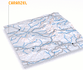 Places with similar names to Cărănzel, Romania ::
// Cranzahl (DE)
// Garnzell (DE)
// Cornozuelo (PA)
// Gorno Selo (BG)
// Krayno Selo (BG)
// Gornăcel (RO)
// Karansıllı (TR)
// Kurancılı (TR)
// Kurunzulay (RU)
// Carnisala (CO)
Disclaimer :: Information on this page comes without warranty of any kind |
||
|
Where is Cărănzel? Elevation and coordinates ::
Latitude (lat): 46°50'0"N Longitude (lon): 22°2'0"E
Elevation (approx.): 199m (map arrows pan, magnifying glasses zoom) |
||
|
Visiting Cărănzel? Hotel/Accommodation ::
Book a hotel in Cărănzel Travel Guide ::
Buy a travel guide for Romania rental cars ::
car rental offers GPS waypoint ::
download a GPX waypoint (PoI) of Cărănzel for your GPS receiver
|
||