|
search place name
|
||
Frînceşti (Covurlui, Romania)Frînceşti is a town in the Covurlui region of Romania. An overview map of the region around Frînceşti is displayed below.
regional and 3d topo map of Frînceşti, Romania ::

Frînceşti airports ::
The nearest airport is CSB - Caransebes, located 72.9 km north west of Frînceşti.
Other airports nearby include CRA - Craiova (107.9 km south east), SBZ - Sibiu (112.8 km north east), TSR - Timisoara Traian Vuia (156.4 km north west), ARW - Arad (184.9 km north west), Nearby towns ::
Boaşca (0.0km north) //
Peştişani (2.3km south west) //
Valea Mare (3.7km north) //
Hobiţa (3.9km south) //
Boroşteni (3.2km north west) //
Gureni (3.9km north) //
Brădiceni (4.5km south east) //
Drăgoeşti (4.5km south east) //
Vîlcele (3.9km west) //
Bîlta (5.4km north east) //
Seuca (7.4km south) //
Topeşti (5.2km west) //
Teleştii-Moşteni (7.9km south) //
Valea Şerpilor (7.9km south) //
Vînăta (6.4km south west) //
Bîltişoara (6.4km north east) //
[all distances 'as the bird flies' and approximate] 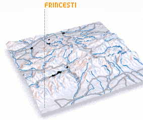
Disclaimer :: Information on this page comes without warranty of any kind |
||
|
Where is Frînceşti? Elevation and coordinates ::
Latitude (lat): 45°5'0"N Longitude (lon): 23°3'0"E
Elevation (approx.): 260m (map arrows pan, magnifying glasses zoom) |
||
|
Visiting Frînceşti? Hotel/Accommodation ::
Book a hotel in Frînceşti Travel Guide ::
Buy a travel guide for Romania rental cars ::
car rental offers GPS waypoint ::
download a GPX waypoint (PoI) of Frînceşti for your GPS receiver
|
||