|
search place name
|
||
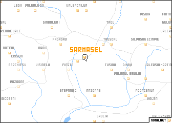
Sărmăşel (Covurlui, Romania)Sărmăşel is a town in the Covurlui region of Romania. An overview map of the region around Sărmăşel is displayed below.
regional and 3d topo map of Sărmăşel, Romania ::
Sărmăşel airports ::
The nearest airport is TGM - Tirgu Mures Vidrasau, located 36.0 km south east of Sărmăşel.
Other airports nearby include CLJ - Cluj-napoca Cluj Napoca (38.2 km west), SBZ - Sibiu (107.4 km south), BAY - Baia Mare Tautii Magheraus (114.5 km north west), SUJ - Satu Mare (144.5 km north west), Nearby towns ::
Larga (1.3km west) //
Ţăgşor-Gară (1.3km west) //
Larsa (1.3km west) //
Titiana (1.3km west) //
Moruţ (1.3km west) //
Sărmaşu (1.3km west) //
Balda (3.1km south west) //
Fînaţe (3.1km south west) //
Sărmăşel-Gara (4.5km north east) //
Tuşinu (4.2km south east) //
Făgădău (5.3km north west) //
Cămăraşu (5.3km north west) //
Ţăgşoru (5.3km north east) //
Răzoare (7.5km south) //
Ştefănuc (7.8km south) //
Săuliţa (7.8km south) //
Miheşu de Cîmpie (7.8km south) //
Mogoaia (7.8km south) //
Groapa Radii (7.8km south) //
Ciurgău (7.8km south) //
Lăpuş (7.8km south) //
Bujor (7.8km south) //
Ţagu (8.3km north east) //
Sîmboleni (9.0km north west) //
[all distances 'as the bird flies' and approximate]  Places with similar names to Sărmăşel, Romania ::
// Zirmoisel (DE)
// Zermezeele (FR)
Disclaimer :: Information on this page comes without warranty of any kind |
||
|
Where is Sărmăşel? Elevation and coordinates ::
Latitude (lat): 46°45'0"N Longitude (lon): 24°11'0"E
Elevation (approx.): 405m (map arrows pan, magnifying glasses zoom) |
||
|
Visiting Sărmăşel? Hotel/Accommodation ::
Book a hotel in Sărmăşel Travel Guide ::
Buy a travel guide for Romania rental cars ::
car rental offers GPS waypoint ::
download a GPX waypoint (PoI) of Sărmăşel for your GPS receiver
|
||