|
search place name
|
||
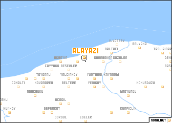
Alayazı (Kastamonu, Turkey)Alayazı is a town in the Kastamonu region of Turkey. An overview map of the region around Alayazı is displayed below.
regional and 3d topo map of Alayazı, Turkey ::
Alayazı airports ::
The nearest airport is ESB - Ankara Esenboga, located 207.5 km south of Alayazı.
Nearby towns ::
Kuşkayası (1.4km west) //
Günebakan (2.8km east) //
Kıranlıkoz (4.0km south) //
Beşevler (3.3km south west) //
Yurtbaşı (4.0km south) //
Çakırlı (4.0km south) //
Yalçınköy (4.6km south west) //
Akbayır (4.1km west) //
Yeniköy (5.7km south) //
Baltacı (4.5km north east) //
Kayaardı (5.6km south east) //
Beltepe (6.2km south west) //
Çataloluk (6.2km south east) //
Gözalan (5.5km east) //
Çayyaka (5.8km west) //
İlyasbey (6.2km north east) //
[all distances 'as the bird flies' and approximate] 
Disclaimer :: Information on this page comes without warranty of any kind |
||
|
Where is Alayazı? Elevation and coordinates ::
Latitude (lat): 41°59'0"N Longitude (lon): 33°17'0"E
Elevation (approx.): 402m (map arrows pan, magnifying glasses zoom) |
||
|
Visiting Alayazı? Hotel/Accommodation ::
Book a hotel in Alayazı Travel Guide ::
Buy a travel guide for Turkey rental cars ::
car rental offers GPS waypoint ::
download a GPX waypoint (PoI) of Alayazı for your GPS receiver
|
||