|
search place name
|
||
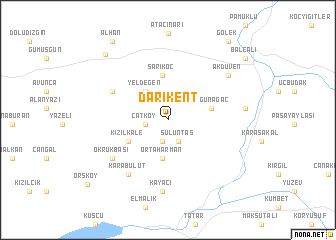
Darıkent (Tunceli, Turkey)Darıkent is a town in the Tunceli region of Turkey. An overview map of the region around Darıkent is displayed below.
regional and 3d topo map of Darıkent, Turkey ::
Darıkent airports ::
The nearest airport is EZS - Elazig, located 60.3 km south west of Darıkent.
Other airports nearby include ERC - Erzincan (85.4 km north), DIY - Diyabakir Diyarbakir (124.5 km south), ERZ - Erzurum (160.4 km north east), MLX - Malatya Erhac (160.6 km west), Nearby towns ::
Özdek (2.5km south) //
Çatköy (2.0km west) //
Sülüntaş (2.6km south) //
Yeldeğen (3.7km north west) //
Ortaharman (4.3km south) //
Kızılkale (4.2km south west) //
Sarıkoç (5.0km north) //
Yoğunağaç (4.0km east) //
Aktarla (5.8km north west) //
Karabulut (7.0km south west) //
Okrukbaşı (6.4km south west) //
Kayacı (8.0km south) //
Akdüven (7.3km north east) //
Yaşaroğlu (6.8km east) //
Örenici (9.1km north west) //
Alhan (10.0km north west) //
Balcalı (9.6km north east) //
Gölek (10.2km north east) //
[all distances 'as the bird flies' and approximate]  Places with similar names to Darıkent, Turkey ::
// Tri Kondy (RU)
// Targant (MA)
// Targant (MA)
// Tirknit (MA)
// Dreckente (DE)
// Dragonetti (IT)
// Dirkintai (LT)
// Dragonte (ES)
// Torquiendo (ES)
// Tergniet (ZA)
Disclaimer :: Information on this page comes without warranty of any kind |
||
|
Where is Darıkent? Elevation and coordinates ::
Latitude (lat): 38°58'18"N Longitude (lon): 39°48'21"E
Elevation (approx.): 1298m (map arrows pan, magnifying glasses zoom) |
||
|
Visiting Darıkent? Hotel/Accommodation ::
Book a hotel in Darıkent Travel Guide ::
Buy a travel guide for Turkey rental cars ::
car rental offers GPS waypoint ::
download a GPX waypoint (PoI) of Darıkent for your GPS receiver
|
||