|
search place name
|
||
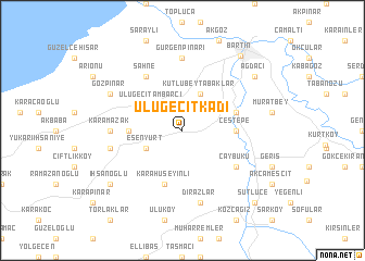
Ulugeçitkadı (Turkey)Ulugeçitkadı is a town in Turkey. An overview map of the region around Ulugeçitkadı is displayed below.
regional and 3d topo map of Ulugeçitkadı, Turkey ::
Ulugeçitkadı airports ::
The nearest airport is ESB - Ankara Esenboga, located 170.7 km south of Ulugeçitkadı.
Other airports nearby include ANK - Ankara Etimesgut (182.8 km south), ESK - Eskisehir (244.7 km south west), Nearby towns ::
Ulugeçit Ambarcı (3.5km north west) //
Kutlubeytabaklar (4.0km north) //
Esenyurt (3.3km south west) //
Çeştepe (4.2km east) //
Bayıryüzü (4.2km west) //
Karahüseyinli (5.7km south) //
Tuzcular (4.6km north east) //
Gecen (4.6km north east) //
Şahne (6.2km north west) //
Çaybükü (5.6km south east) //
Gürgenpınarı (7.4km north) //
Karamazak (5.5km west) //
Akmanlar (5.8km west) //
Dırazlar (7.5km south) //
Gözpınar (6.7km north west) //
İhsanoğlu (7.9km south west) //
Ağdacı (7.9km north east) //
Bartın (8.9km north east) //
Sütlüce (9.3km south east) //
[all distances 'as the bird flies' and approximate] 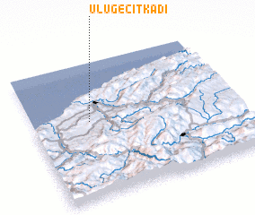 Places with similar names to Ulugeçitkadı, Turkey :: Disclaimer :: Information on this page comes without warranty of any kind |
||
|
Where is Ulugeçitkadı? Elevation and coordinates ::
Latitude (lat): 41°34'0"N Longitude (lon): 32°17'0"E
Elevation (approx.): 120m (map arrows pan, magnifying glasses zoom) |
||
|
Visiting Ulugeçitkadı? Hotel/Accommodation ::
Book a hotel in Ulugeçitkadı Travel Guide ::
Buy a travel guide for Turkey rental cars ::
car rental offers GPS waypoint ::
download a GPX waypoint (PoI) of Ulugeçitkadı for your GPS receiver
|
||