|
search place name
|
||
Berëzovitsa (Ukraine)Berëzovitsa is a town in Ukraine. An overview map of the region around Berëzovitsa is displayed below.
regional and 3d topo map of Berëzovitsa, Ukraine ::

Berëzovitsa airports ::
The nearest airport is LWO - Lvov Lviv Intl, located 108.7 km north west of Berëzovitsa.
Other airports nearby include BAY - Baia Mare Tautii Magheraus (175.3 km south west), SCV - Suceava Stefan Cel Mare (186.8 km south east), SUJ - Satu Mare (198.4 km south west), Nearby towns ::
Kolodeyevka (2.2km south east) //
Vovchynetsʼ (3.4km south) //
Dobrovlyany (2.4km east) //
Yamnytsya (3.2km west) //
Uhryniv (4.4km south west) //
Podluzhe (5.7km south) //
Yastshenbets (4.1km north east) //
Selets (5.7km north) //
Zhovtenʼ (6.1km north east) //
Tyazev (5.2km north west) //
Uzyn (4.9km east) //
Ugorniki (7.5km south) //
Leonuvka (6.7km south west) //
Pidpechery (7.0km south east) //
Gannusovka (6.1km north east) //
Ivano-Frankivsʼk (8.0km south west) //
Pasechna (7.4km south west) //
[all distances 'as the bird flies' and approximate] 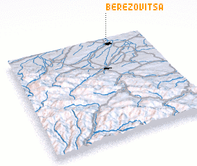 Places with similar names to Berëzovitsa, Ukraine ::
// Beržvaitis (LT)
// Brusevtsi (BG)
// Berëzovets (UA)
// Berëzovets (RU)
// Berëzovets (RU)
// Berëzovets (RU)
// Berëzovitsa (RU)
// Brusovets (RU)
// Berëzovets (RU)
// Berëzovets (RU)
Disclaimer :: Information on this page comes without warranty of any kind |
||
|
Where is Berëzovitsa? Elevation and coordinates ::
Latitude (lat): 48°59'0"N Longitude (lon): 24°45'0"E
Elevation (approx.): 333m (map arrows pan, magnifying glasses zoom) |
||
|
Visiting Berëzovitsa? Hotel/Accommodation ::
Book a hotel in Berëzovitsa Travel Guide ::
Buy a travel guide for Ukraine rental cars ::
car rental offers GPS waypoint ::
download a GPX waypoint (PoI) of Berëzovitsa for your GPS receiver
|
||