|
search place name
|
||
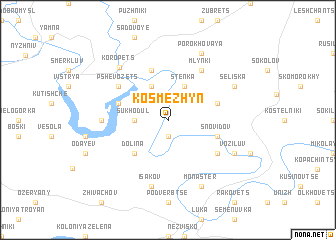
Kosʼmezhyn (Ukraine)Kosʼmezhyn is a town in Ukraine. An overview map of the region around Kosʼmezhyn is displayed below.
regional and 3d topo map of Kosʼmezhyn, Ukraine ::
Kosʼmezhyn airports ::
The nearest airport is LWO - Lvov Lviv Intl, located 138.9 km north west of Kosʼmezhyn.
Other airports nearby include SCV - Suceava Stefan Cel Mare (156.8 km south east), BAY - Baia Mare Tautii Magheraus (188.9 km south west), Nearby towns ::
Sekerchin (1.9km south) //
Sukhodul (2.4km west) //
Deleva (3.9km north) //
Stenka (3.9km north) //
Dolina (4.4km south west) //
Snovidov (4.1km south east) //
Vadova (5.7km north) //
Rublin (4.1km north east) //
Budzynʼ (4.1km north west) //
Petrov (5.2km south east) //
Mlynki (6.1km north east) //
Pshevozets (5.2km north west) //
Koloniya Bzhezina (4.9km west) //
Isakov (7.5km south) //
Koropetsʼ (6.9km north west) //
Monaster (7.8km south) //
Voziluv (6.1km south east) //
Seliska (6.1km north east) //
Porokhovaya (7.8km north) //
[all distances 'as the bird flies' and approximate] 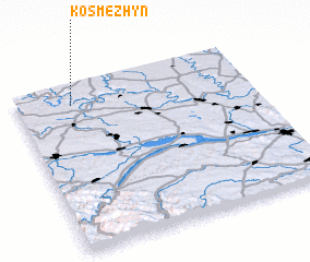 Places with similar names to Kosʼmezhyn, Ukraine ::
// Kosmasson (BF)
// Kousoumason (BF)
Disclaimer :: Information on this page comes without warranty of any kind |
||
|
Where is Kosʼmezhyn? Elevation and coordinates ::
Latitude (lat): 48°53'0"N Longitude (lon): 25°14'0"E
Elevation (approx.): 263m (map arrows pan, magnifying glasses zoom) |
||
|
Visiting Kosʼmezhyn? Hotel/Accommodation ::
Book a hotel in Kosʼmezhyn Travel Guide ::
Buy a travel guide for Ukraine rental cars ::
car rental offers GPS waypoint ::
download a GPX waypoint (PoI) of Kosʼmezhyn for your GPS receiver
|
||