|
search place name
|
||
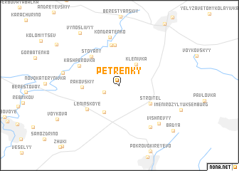
Petrenky (Donetsʼka Oblastʼ, Ukraine)Petrenky is a town in the Donetsʼka Oblastʼ region of Ukraine. An overview map of the region around Petrenky is displayed below.
regional and 3d topo map of Petrenky, Ukraine ::
Petrenky airports ::
The nearest airport is DOK - Donetsk Intl, located 52.9 km north west of Petrenky.
Other airports nearby include ROV - Rostov Na Donu (131.0 km south east), Nearby towns ::
Shevchenko (2.0km south west) //
Isayeva Balka (3.4km north east) //
Klenivka (3.7km north east) //
Koloski (4.4km south) //
Stroitelʼ (4.4km south east) //
Rakovskiy (4.0km west) //
Leninskoye (5.0km south west) //
Stoyany (5.4km north west) //
Osykove (6.3km north) //
Platonovskiy (6.3km north) //
Kashperovka (5.3km north west) //
Kondratenko (7.6km north) //
Kurʼyanskiy (7.4km south east) //
Vishnëvyy (7.3km south east) //
Vynoslivyy (9.2km north west) //
Badʼya (9.1km south east) //
[all distances 'as the bird flies' and approximate]  Places with similar names to Petrenky, Ukraine ::
// Padering (DE)
// Pietronki (PL)
// Põdrangu (EE)
// Paternieki (LV)
// Pēternieki (LV)
// Petranka (UA)
// Pata Renca (GT)
// Potranca (MX)
// Pietranico (IT)
// Pédernec (FR)
Disclaimer :: Information on this page comes without warranty of any kind |
||
|
Where is Petrenky? Elevation and coordinates ::
Latitude (lat): 47°43'33"N Longitude (lon): 38°13'21"E
Elevation (approx.): 145m (map arrows pan, magnifying glasses zoom) |
||
|
Visiting Petrenky? Hotel/Accommodation ::
Book a hotel in Petrenky Travel Guide ::
Buy a travel guide for Ukraine rental cars ::
car rental offers GPS waypoint ::
download a GPX waypoint (PoI) of Petrenky for your GPS receiver
|
||