|
search place name
|
||
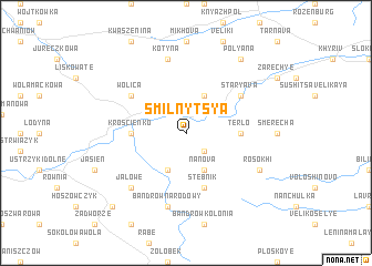
Smilʼnytsya (Ukraine)Smilʼnytsya is a town in Ukraine. An overview map of the region around Smilʼnytsya is displayed below.
regional and 3d topo map of Smilʼnytsya, Ukraine ::
Smilʼnytsya airports ::
The nearest airport is RZE - Rzeszow Jasionka, located 87.4 km north west of Smilʼnytsya.
Other airports nearby include LWO - Lvov Lviv Intl (97.4 km north east), KSC - Kosice (140.0 km south west), SUJ - Satu Mare (196.5 km south), BAY - Baia Mare Tautii Magheraus (208.6 km south), Nearby towns ::
Rudavka (2.2km south east) //
Lopushnitsa (3.9km north) //
Nanova (3.9km south) //
Steinfels (3.9km south) //
Terlo (3.6km east) //
Krościenko (3.6km west) //
Stebnik (5.7km south) //
Starʼyava (5.2km north east) //
Wolica (5.2km north west) //
Obersdorf (5.2km north west) //
Kotyna (7.5km north) //
Bandrów Narodowy (7.5km south) //
Jałowe (6.6km south west) //
Rosokhi (6.1km south east) //
Polyana (8.2km north east) //
Hoszów (8.8km south west) //
[all distances 'as the bird flies' and approximate] 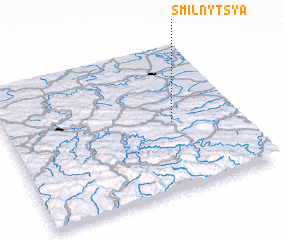 Places with similar names to Smilʼnytsya, Ukraine :: Disclaimer :: Information on this page comes without warranty of any kind |
||
|
Where is Smilʼnytsya? Elevation and coordinates ::
Latitude (lat): 49°28'0"N Longitude (lon): 22°43'0"E
Elevation (approx.): 503m (map arrows pan, magnifying glasses zoom) |
||
|
Visiting Smilʼnytsya? Hotel/Accommodation ::
Book a hotel in Smilʼnytsya Travel Guide ::
Buy a travel guide for Ukraine rental cars ::
car rental offers GPS waypoint ::
download a GPX waypoint (PoI) of Smilʼnytsya for your GPS receiver
|
||