|
search place name
|
||
Bou Aleg (Nabeul, Tunisia)Bou Aleg is a town in the Nabeul region of Tunisia. An overview map of the region around Bou Aleg is displayed below.
regional and 3d topo map of Bou Aleg, Tunisia ::

Bou Aleg airports ::
The nearest airport is TUN - Tunis Carthage, located 55.9 km west of Bou Aleg.
Other airports nearby include PNL - Pantelleria (99.5 km east), MIR - Monastir Habib Bourguiba Intl (121.7 km south), TPS - Trapani Birgi (186.4 km north east), LMP - Lampedusa (218.5 km south east), Nearby towns ::
Dar el Haoui (0.9km north west) //
Dar Ahmed Msakni (1.4km south west) //
Dar Mohammed Ben Hazaz (2.3km north) //
Dar el Guedidi (2.9km north) //
Dar Bou Habib (3.0km north) //
Dar Ahmed Mohammed ed Derouich (2.7km north east) //
Dar Haj en Nour (3.1km east) //
Dar el Mouldi (3.7km north west) //
Dar Bou Khelif (4.1km north east) //
Dār Sūdān (4.3km south west) //
Beni Hazaz (4.0km north east) //
Tazoghrane (4.9km north) //
Douar Maaoui Ben Saïd (4.8km north west) //
Dar Soudane (4.9km south west) //
Douar ez Zedine (5.0km south east) //
Douar er Rainine (4.5km east) //
Dar Khalifa Ben Hassene (5.6km north east) //
Dar el Oudiane (6.3km south) //
Douar Cheikh Amar (5.3km east) //
Borj el Bey (5.2km east) //
Dar Dred (5.7km north west) //
Douar Mennzel Aïssa (5.3km east) //
El Oudiane (6.7km south) //
Dar Jdida (7.1km north) //
Dar Chaouch Ali (5.8km east) //
Douar Zougjag (6.6km north west) //
Dar Oulad Daoued (7.3km south) //
Kef el Mechta (7.2km south) //
Dar Ahmed Ben Keani (7.0km north east) //
[all distances 'as the bird flies' and approximate] 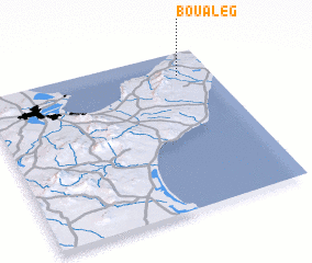 Places with similar names to Bou Aleg, Tunisia ::
Disclaimer :: Information on this page comes without warranty of any kind |
||
|
Where is Bou Aleg? Elevation and coordinates ::
Latitude (lat): 36°51'7"N Longitude (lon): 10°51'16"E
Elevation (approx.): 98m (map arrows pan, magnifying glasses zoom) |
||
|
Visiting Bou Aleg? Hotel/Accommodation ::
Book a hotel in Bou Aleg Travel Guide ::
Buy a travel guide for Tunisia rental cars ::
car rental offers GPS waypoint ::
download a GPX waypoint (PoI) of Bou Aleg for your GPS receiver
|
||