|
search place name
|
||
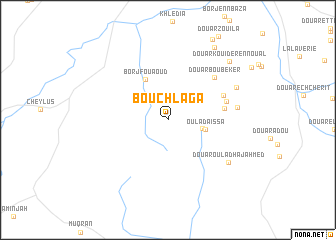
Bou Chlaga (Nabeul, Tunisia)Bou Chlaga is a town in the Nabeul region of Tunisia. An overview map of the region around Bou Chlaga is displayed below.
regional and 3d topo map of Bou Chlaga, Tunisia ::
Bou Chlaga airports ::
The nearest airport is TUN - Tunis Carthage, located 34.0 km north of Bou Chlaga.
Other airports nearby include MIR - Monastir Habib Bourguiba Intl (101.3 km south east), PNL - Pantelleria (161.9 km east), SFA - Sfax Thyna (207.9 km south), Nearby towns ::
Douar Bou Said (3.3km east) //
Oulad Aissa (3.6km east) //
Borj Fouaoud (5.0km north west) //
Douar Hamrouna (5.2km east) //
Douar Mbarek (5.7km north east) //
Douar Abd el Kader (5.7km east) //
Douar Bou Beker (6.3km north east) //
Douar Mohammed Ben Rejeb (6.4km east) //
Douar Oulad Haj Ahmed (7.2km south east) //
Douar Ben Miled (7.1km north east) //
Douar Kouider en Noual (8.5km north east) //
Douar er Rahmane (9.1km north east) //
[all distances 'as the bird flies' and approximate] 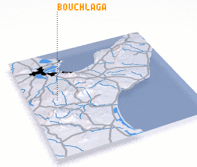 Places with similar names to Bou Chlaga, Tunisia ::
// Bashlyki (UA)
// Buchalki (RU)
// Bychiy Lug (RU)
// Bushlak (UZ)
// Bay-Shulak (RU)
// Beach Lake (US)
// Bách Lộc (VN)
// Bechilga (DZ)
Disclaimer :: Information on this page comes without warranty of any kind |
||
|
Where is Bou Chlaga? Elevation and coordinates ::
Latitude (lat): 36°32'48"N Longitude (lon): 10°11'18"E
Elevation (approx.): 246m (map arrows pan, magnifying glasses zoom) |
||
|
Visiting Bou Chlaga? Hotel/Accommodation ::
Book a hotel in Bou Chlaga Travel Guide ::
Buy a travel guide for Tunisia rental cars ::
car rental offers GPS waypoint ::
download a GPX waypoint (PoI) of Bou Chlaga for your GPS receiver
|
||