|
search place name
|
||
Oulad Nasseur (Kairouan, Tunisia)Oulad Nasseur is a town in the Kairouan region of Tunisia. An overview map of the region around Oulad Nasseur is displayed below.
regional and 3d topo map of Oulad Nasseur, Tunisia ::

Oulad Nasseur airports ::
The nearest airport is SFA - Sfax Thyna, located 92.2 km south east of Oulad Nasseur.
Other airports nearby include MIR - Monastir Habib Bourguiba Intl (101.7 km north east), GAF - Gafsa (128.7 km south west), GAE - Gabes (148.2 km south), TEE - Tebessa Cheikh Larbi Tebessi (161.0 km west), Nearby towns ::
Ouled Zaïr (1.7km north west) //
Laouainiah (3.0km south west) //
Ouled Abd er Rahmane (3.8km south) //
Dar Mannsour Bou Amara (4.3km east) //
Dar Sialah (5.9km south east) //
El Abadlia (6.5km south) //
El Erijat (8.2km south east) //
El Hadeba (7.8km north west) //
[all distances 'as the bird flies' and approximate] 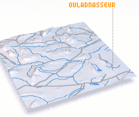 Places with similar names to Oulad Nasseur, Tunisia ::
// Oulad Nasser (MA)
// Oulad Ounzar (MA)
// Oulad Nouasseur (TN)
// Oulad Nacer (MA)
// Oulad Nasser (MA)
// Oulad Nasser (MA)
// Oulad Nasser (MA)
// Oulad-Nasseur (MA)
Disclaimer :: Information on this page comes without warranty of any kind |
||
|
Where is Oulad Nasseur? Elevation and coordinates ::
Latitude (lat): 35°11'54"N Longitude (lon): 9°52'4"E
Elevation (approx.): 228m (map arrows pan, magnifying glasses zoom) |
||
|
Visiting Oulad Nasseur? Hotel/Accommodation ::
Book a hotel in Oulad Nasseur Travel Guide ::
Buy a travel guide for Tunisia rental cars ::
car rental offers GPS waypoint ::
download a GPX waypoint (PoI) of Oulad Nasseur for your GPS receiver
|
||