|
search place name
|
||
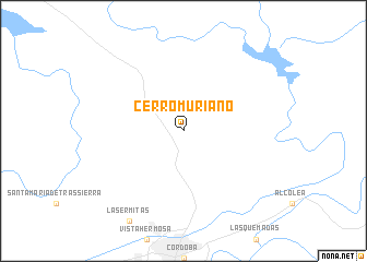
Cerro Muriano (Andalucía, Spain)Cerro Muriano is a town in the Andalucía region of Spain. An overview map of the region around Cerro Muriano is displayed below.
regional and 3d topo map of Cerro Muriano, Spain ::
Cerro Muriano airports ::
The nearest airport is ODB - Cordoba, located 19.0 km south of Cerro Muriano.
Other airports nearby include OZP - Sevilla Moron Ab (118.4 km south west), SVQ - Sevilla (118.5 km south west), GRX - Granada (125.5 km south east), GRX - Granada Armilla (138.7 km south east), Nearby towns ::
[all distances 'as the bird flies' and approximate]  Places with similar names to Cerro Muriano, Spain ::
// Sierra Morena (CU)
// Sierra Morena (CO)
// Sierra Morena (MX)
// Sar Mūrān (IR)
// Cirò Marina (IT)
// Sārmarān (IR)
Disclaimer :: Information on this page comes without warranty of any kind |
||
|
Where is Cerro Muriano? Elevation and coordinates ::
Latitude (lat): 38°0'0"N Longitude (lon): 4°46'0"W
Elevation (approx.): 511m (map arrows pan, magnifying glasses zoom) |
||
|
Visiting Cerro Muriano? Hotel/Accommodation ::
Book a hotel in Cerro Muriano Travel Guide ::
Buy a travel guide for Spain rental cars ::
car rental offers GPS waypoint ::
download a GPX waypoint (PoI) of Cerro Muriano for your GPS receiver
|
||