|
search place name
|
||
Las Oliveras (Murcia, Spain)Las Oliveras is a town in the Murcia region of Spain. An overview map of the region around Las Oliveras is displayed below.
regional and 3d topo map of Las Oliveras, Spain ::

Las Oliveras airports ::
The nearest airport is MJV - Murcia San Javier, located 80.8 km east of Las Oliveras.
Other airports nearby include LEI - Almeria (99.3 km south west), ALC - Alicante (128.0 km north east), GRX - Granada Armilla (179.1 km west), ORN - Oran Es Senia (233.9 km south east), Nearby towns ::
La Galera (NaNkm north) //
Los Jopos (NaNkm north) //
Las Norias (1.5km west) //
Los Abades (2.4km north west) //
Pelile y El Jurado (4.4km west) //
Turbinto (4.8km south west) //
El Vado (6.3km north east) //
Casa Castillo (7.6km north) //
El Esparragal (6.2km west) //
Barranco de los Asensios (8.0km south) //
Barranco del Atalayón (8.0km south) //
Esparragalico (6.9km north west) //
[all distances 'as the bird flies' and approximate] 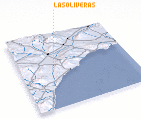 Places with similar names to Las Oliveras, Spain ::
// Los Olivares (ES)
// Los Alvarez (US)
// Los Álvarez (MX)
// Los Alfaros (HN)
// Los Olivares (AR)
// Les Olliviers (FR)
Disclaimer :: Information on this page comes without warranty of any kind |
||
|
Where is Las Oliveras? Elevation and coordinates ::
Latitude (lat): 37°33'0"N Longitude (lon): 1°41'0"W
Elevation (approx.): 337m (map arrows pan, magnifying glasses zoom) |
||
|
Visiting Las Oliveras? Hotel/Accommodation ::
Book a hotel in Las Oliveras Travel Guide ::
Buy a travel guide for Spain rental cars ::
car rental offers GPS waypoint ::
download a GPX waypoint (PoI) of Las Oliveras for your GPS receiver
|
||