|
search place name
|
||
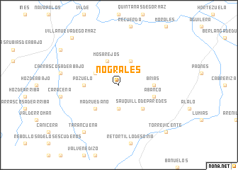
Nograles (Castilla y León, Spain)Nograles is a town in the Castilla y León region of Spain. An overview map of the region around Nograles is displayed below.
regional and 3d topo map of Nograles, Spain ::
Nograles airports ::
The nearest airport is TOJ - Madrid Torrejon, located 107.1 km south of Nograles.
Other airports nearby include MAD - Madrid Barajas (111.4 km south west), VLL - Valladolid (158.2 km west), ZAZ - Zaragoza Ab (166.1 km east), VIT - Vitoria (166.3 km north), Nearby towns ::
Modamio (3.7km south) //
La Perera (3.3km north west) //
Mosarejos (4.0km north) //
Galapagares (4.0km north) //
Sauquillo de Paredes (4.6km south east) //
Madruédano (4.6km south west) //
Brías (4.2km east) //
Pozuelo (4.2km west) //
Abanco (4.6km south east) //
Tarancueña (8.5km south west) //
Torrevicente (9.3km south east) //
Villanueva de Gormaz (9.3km north west) //
[all distances 'as the bird flies' and approximate] 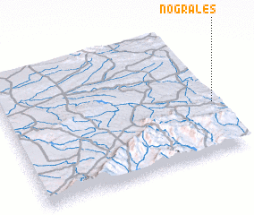 Places with similar names to Nograles, Spain ::
// Neckarelz (DE)
// Negrelos (PT)
// Negrelos (PT)
// Negrelos (PT)
// Negrelos (PT)
// Negrileasa (RO)
// Negrelos (ES)
// Nogueruelas (ES)
// Negro Luis (VE)
// Negrillos (BO)
Disclaimer :: Information on this page comes without warranty of any kind |
||
|
Where is Nograles? Elevation and coordinates ::
Latitude (lat): 41°24'0"N Longitude (lon): 3°0'0"W
Elevation (approx.): 1144m (map arrows pan, magnifying glasses zoom) |
||
|
Visiting Nograles? Hotel/Accommodation ::
Book a hotel in Nograles Travel Guide ::
Buy a travel guide for Spain rental cars ::
car rental offers GPS waypoint ::
download a GPX waypoint (PoI) of Nograles for your GPS receiver
|
||