|
search place name
|
||
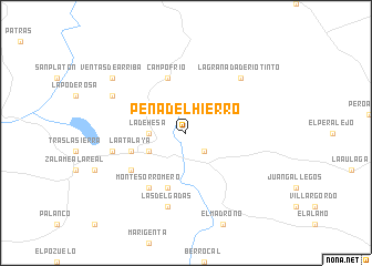
Peña del Hierro (Andalucía, Spain)Peña del Hierro is a town in the Andalucía region of Spain. An overview map of the region around Peña del Hierro is displayed below.
regional and 3d topo map of Peña del Hierro, Spain ::
Peña del Hierro airports ::
The nearest airport is SVQ - Sevilla, located 66.8 km south east of Peña del Hierro.
Other airports nearby include OZP - Sevilla Moron Ab (102.2 km south east), XRY - Jerez (116.3 km south), BJZ - Badajoz Talavera La Real (132.5 km north), FAO - Faro (147.7 km south west), Nearby towns ::
Nerva (2.4km south east) //
La Dehesa (2.9km west) //
Minas de Ríotinto (3.5km south west) //
La Naya (5.8km south) //
La Atalaya (4.8km south west) //
Campofrío (5.7km north) //
Monte Sorromero (6.3km south west) //
Vista Alegre (5.8km south west) //
Mina (6.2km west) //
Las Delgadas (7.6km south) //
La Granada de Río Tinto (7.1km north east) //
La Majada (6.9km north west) //
Ventas de Arriba (8.1km north west) //
[all distances 'as the bird flies' and approximate] 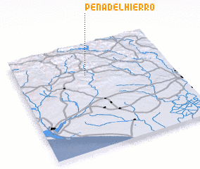 Places with similar names to Peña del Hierro, Spain :: Disclaimer :: Information on this page comes without warranty of any kind |
||
|
Where is Peña del Hierro? Elevation and coordinates ::
Latitude (lat): 37°43'0"N Longitude (lon): 6°33'0"W
Elevation (approx.): 412m (map arrows pan, magnifying glasses zoom) |
||
|
Visiting Peña del Hierro? Hotel/Accommodation ::
Book a hotel in Peña del Hierro Travel Guide ::
Buy a travel guide for Spain rental cars ::
car rental offers GPS waypoint ::
download a GPX waypoint (PoI) of Peña del Hierro for your GPS receiver
|
||