|
search place name
|
||
Peñerudes (Asturias, Spain)Peñerudes is a town in the Asturias region of Spain. An overview map of the region around Peñerudes is displayed below.
regional and 3d topo map of Peñerudes, Spain ::

Peñerudes airports ::
The nearest airport is OVD - Aviles Asturias, located 32.2 km north of Peñerudes.
Other airports nearby include BGC - Braganca (170.6 km south), VLL - Valladolid (196.5 km south east), Nearby towns ::
El Río (0.0km north) //
El Ablanedo (1.3km east) //
Lavares (1.3km west) //
La Vara (2.3km south east) //
Busloñe (2.3km south east) //
Villar (2.7km east) //
La Roza (2.7km east) //
Puerto (3.7km north) //
Tuñón (2.7km west) //
Dosango (2.7km west) //
El Vallín (3.3km south east) //
Grandiella (3.9km south) //
Pedroveya (3.3km south west) //
Rebollada (3.3km south west) //
Pando (3.9km north) //
Las Carangas (3.3km north west) //
Porcío (4.6km south east) //
Caces (5.6km north) //
Castañedo del Monte (4.0km west) //
Castandiello (4.0km east) //
Peñanes (4.0km east) //
Priorio (5.7km north) //
Pintoria (5.7km north) //
Argamé (4.5km north east) //
Soto de Rey (4.5km north east) //
Otura (5.5km south east) //
El Cabornín (6.2km south east) //
Perlín (6.2km north west) //
San Andrés (5.5km north west) //
[all distances 'as the bird flies' and approximate] 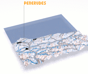
Disclaimer :: Information on this page comes without warranty of any kind |
||
|
Where is Peñerudes? Elevation and coordinates ::
Latitude (lat): 43°17'0"N Longitude (lon): 5°56'0"W
Elevation (approx.): 537m (map arrows pan, magnifying glasses zoom) |
||
|
Visiting Peñerudes? Hotel/Accommodation ::
Book a hotel in Peñerudes Travel Guide ::
Buy a travel guide for Spain rental cars ::
car rental offers GPS waypoint ::
download a GPX waypoint (PoI) of Peñerudes for your GPS receiver
|
||