|
search place name
|
||
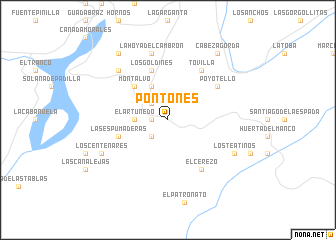
Pontones (Andalucía, Spain)Pontones is a town in the Andalucía region of Spain. An overview map of the region around Pontones is displayed below.
regional and 3d topo map of Pontones, Spain ::
Pontones airports ::
The nearest airport is GRX - Granada Armilla, located 138.7 km south west of Pontones.
Other airports nearby include GRX - Granada (142.2 km south west), LEI - Almeria (143.7 km south), MJV - Murcia San Javier (167.3 km east), AGP - Malaga (227.9 km south west), Nearby towns ::
Pontón Alto (1.5km west) //
Casas Carrasco (2.4km north west) //
Fuente Segura (2.4km south west) //
El Artuñedo (2.9km west) //
La Ballestera (4.0km north) //
Montalvo (4.7km north west) //
Los Goldines (5.7km north) //
Las Espumaderas (4.8km south west) //
Poyotello (5.7km north east) //
Tovilla (6.3km north east) //
El Cerezo (6.3km south east) //
La Hoya del Cambrón (7.6km north) //
La Agracea (7.1km north west) //
Los Centenares (6.9km south west) //
Los Teatinos (6.9km south east) //
Cabeza Gorda (8.6km north east) //
Hornos el Viejo (8.6km north west) //
[all distances 'as the bird flies' and approximate] 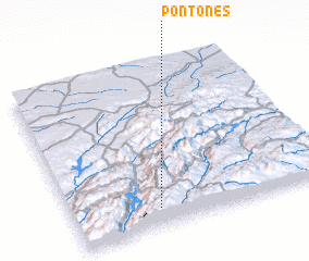 Places with similar names to Pontones, Spain ::
// Pendenza (IT)
// Pandánassa (GR)
// Pandánassa (GR)
// Pandánassa (GR)
// Pantánassa (GR)
// Penedones (PT)
// Pandenes (ES)
// Pendones (ES)
// Pontones (ES)
// Pontóns (ES)
Disclaimer :: Information on this page comes without warranty of any kind |
||
|
Where is Pontones? Elevation and coordinates ::
Latitude (lat): 38°7'0"N Longitude (lon): 2°40'0"W
Elevation (approx.): 1365m (map arrows pan, magnifying glasses zoom) |
||
|
Visiting Pontones? Hotel/Accommodation ::
Book a hotel in Pontones Travel Guide ::
Buy a travel guide for Spain rental cars ::
car rental offers GPS waypoint ::
download a GPX waypoint (PoI) of Pontones for your GPS receiver
|
||