|
search place name
|
||
Quintá de Lor (Cataluña, Spain)Quintá de Lor is a town in the Cataluña region of Spain. An overview map of the region around Quintá de Lor is displayed below.
regional and 3d topo map of Quintá de Lor, Spain ::

Quintá de Lor airports ::
The nearest airport is BGC - Braganca, located 88.1 km south east of Quintá de Lor.
Other airports nearby include SCQ - Santiago (99.0 km north west), VGO - Vigo (110.6 km west), LCG - La Coruna A Coruna (123.3 km north west), VRL - Vila Real (139.9 km south), Nearby towns ::
Barja de Lor (1.9km north) //
Vilar de Lor (3.3km north east) //
San Clodio (4.6km south east) //
Salcedo (5.6km north) //
Nogueira (5.7km south) //
Aguasmestas (5.7km south) //
Ribas del Sil (5.5km south east) //
Brence (5.5km north west) //
Vilachá (5.5km south west) //
Torbeo (6.2km south west) //
Puebla del Brollón (6.2km north west) //
Liñares (5.5km west) //
Quiroga (5.8km east) //
Pinel (5.8km west) //
Castroncelos (6.9km north west) //
Castro Portela (6.6km north east) //
Lamaiglesia (7.9km north) //
Mazo Santigoso (8.5km north east) //
[all distances 'as the bird flies' and approximate] 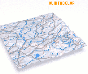 Places with similar names to Quintá de Lor, Spain :: Disclaimer :: Information on this page comes without warranty of any kind |
||
|
Where is Quintá de Lor? Elevation and coordinates ::
Latitude (lat): 42°30'0"N Longitude (lon): 7°20'0"W
Elevation (approx.): 504m (map arrows pan, magnifying glasses zoom) |
||
|
Visiting Quintá de Lor? Hotel/Accommodation ::
Book a hotel in Quintá de Lor Travel Guide ::
Buy a travel guide for Spain rental cars ::
car rental offers GPS waypoint ::
download a GPX waypoint (PoI) of Quintá de Lor for your GPS receiver
|
||