|
search place name
|
||
Razbona (Castilla-La Mancha, Spain)Razbona is a town in the Castilla-La Mancha region of Spain. An overview map of the region around Razbona is displayed below.
regional and 3d topo map of Razbona, Spain ::

Razbona airports ::
The nearest airport is TOJ - Madrid Torrejon, located 45.8 km south west of Razbona.
Other airports nearby include MAD - Madrid Barajas (52.1 km south west), VLL - Valladolid (170.2 km north west), PNA - Pamplona (247.9 km north east), Nearby towns ::
Humanes (4.0km south) //
Mohernando (5.6km south) //
Torrebeleña (5.7km north) //
Cerezo de Mohernando (4.6km north east) //
Puebla de Beleña (5.6km north west) //
Robledillo de Mohernando (5.6km west) //
Alarilla (5.6km east) //
Beleña de Sorbe (7.5km north) //
Aleas (7.5km north) //
Montarrón (7.0km north east) //
Palacio de Heras (7.0km south east) //
Heras (7.9km south east) //
Fuencemillán (9.3km north east) //
[all distances 'as the bird flies' and approximate] 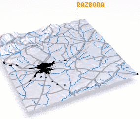 Places with similar names to Razbona, Spain ::
// Razboyna (BG)
// Razboyna (BG)
// Răsboieni (RO)
// Războeni (RO)
// Războeni (RO)
// Războeni (RO)
// Rizia Bana (NE)
// Rāzbīn (IR)
// Raʼs Bunayyā (LB)
// Risbyn (SE)
Disclaimer :: Information on this page comes without warranty of any kind |
||
|
Where is Razbona? Elevation and coordinates ::
Latitude (lat): 40°51'0"N Longitude (lon): 3°10'0"W
Elevation (approx.): 742m (map arrows pan, magnifying glasses zoom) |
||
|
Visiting Razbona? Hotel/Accommodation ::
Book a hotel in Razbona Travel Guide ::
Buy a travel guide for Spain rental cars ::
car rental offers GPS waypoint ::
download a GPX waypoint (PoI) of Razbona for your GPS receiver
|
||